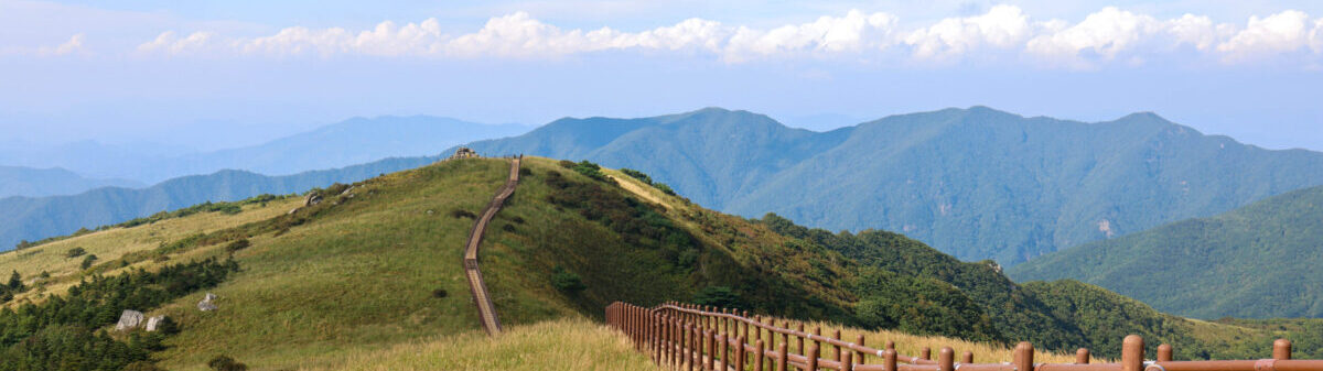
Korea National Park Service(KNPS) carries out trail closure policy to prevent wild fires and protect the ecological environment during dry season.
2) Closed trails
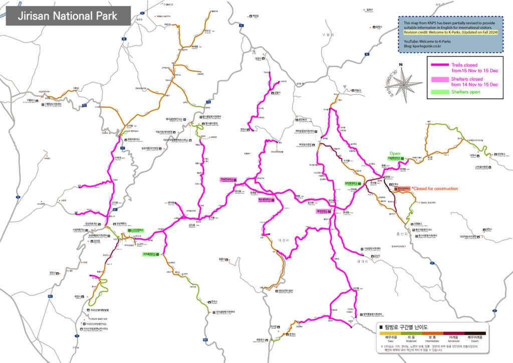
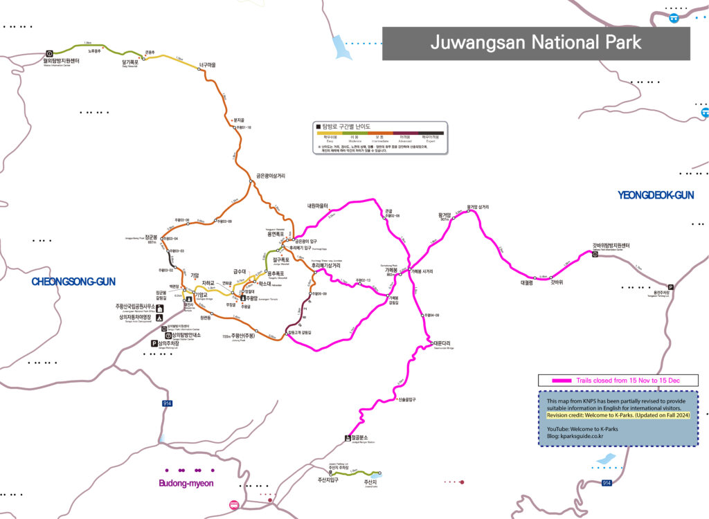
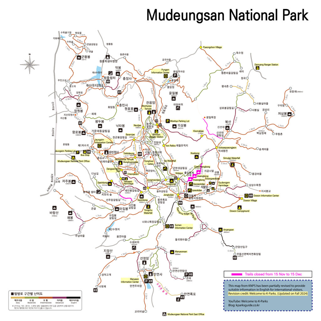
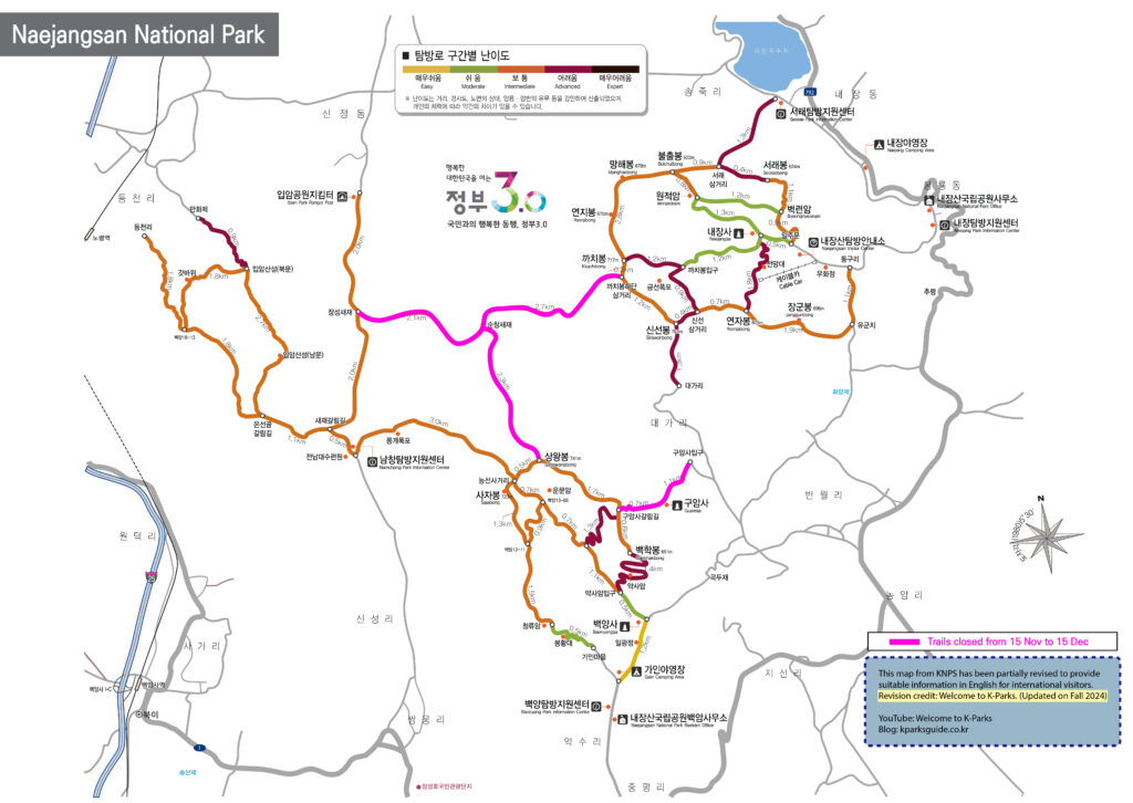
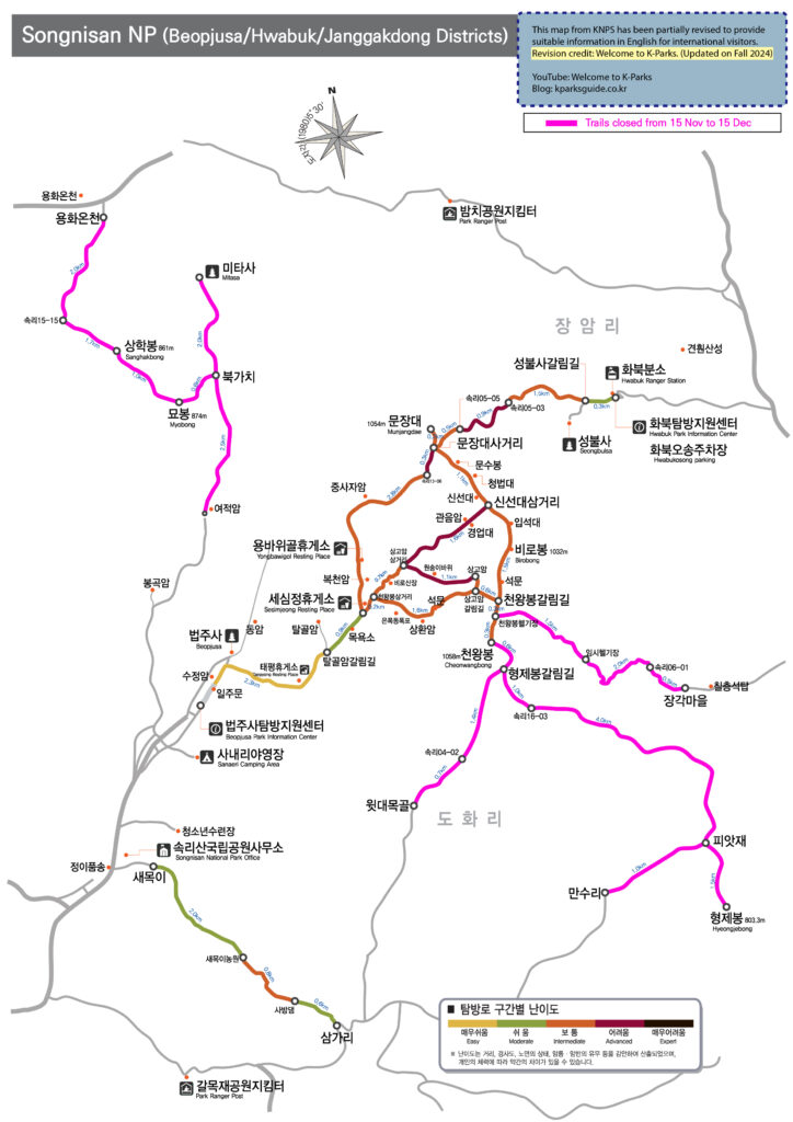
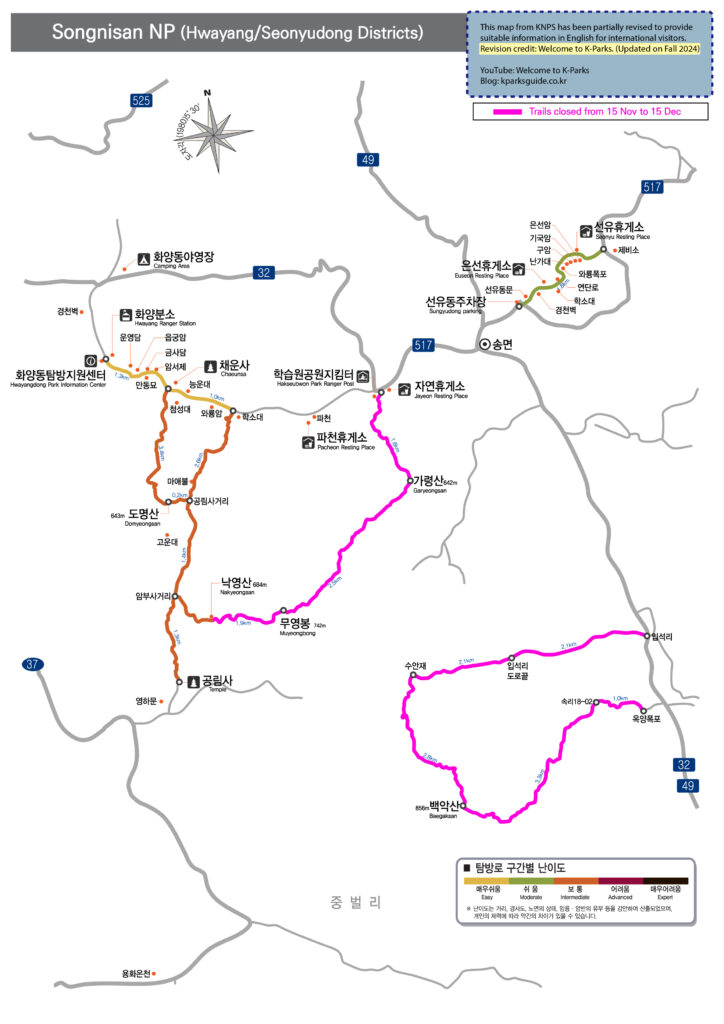
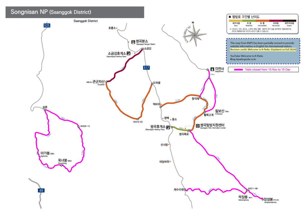
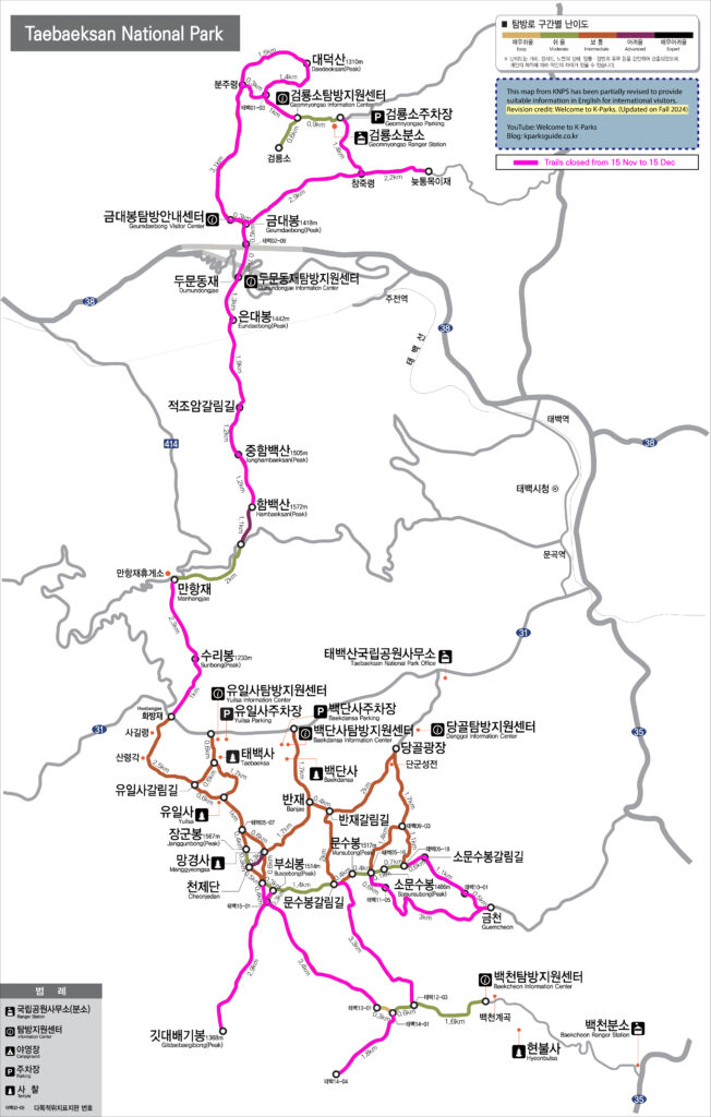
Trail closure policy applies to about 121 sections (570km) within the entire national parks which account for around 20% of the total trails.
3) Closure Period
Trail closure policy during wildfire prevention period is conducted twice a year (spring and fall).
Spring: February 15 ~ May 15
Detailed closure period varies on parks. Next year I will make a posting about Spring trail closure in details.
Fall: November 15 ~ December 15
Closure period is almost fixed but applied parks are slightly different every year. For 2024, see below.
Period
Park Names impacted by this closure policy
Nov.15.∼Dec.15.
(every year)
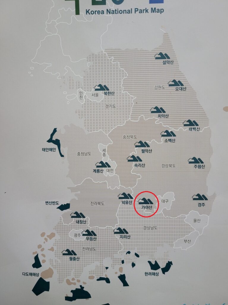
18 national parks out of 23 parks.
(Except for Gyeongju, Hallasan, Gayasan, Dadohaehaesang, Taeanhaean)
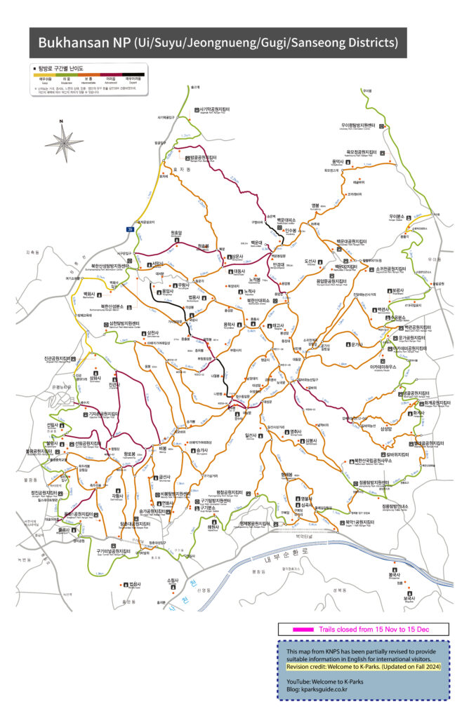
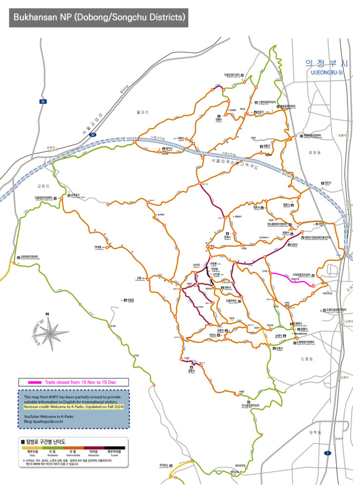
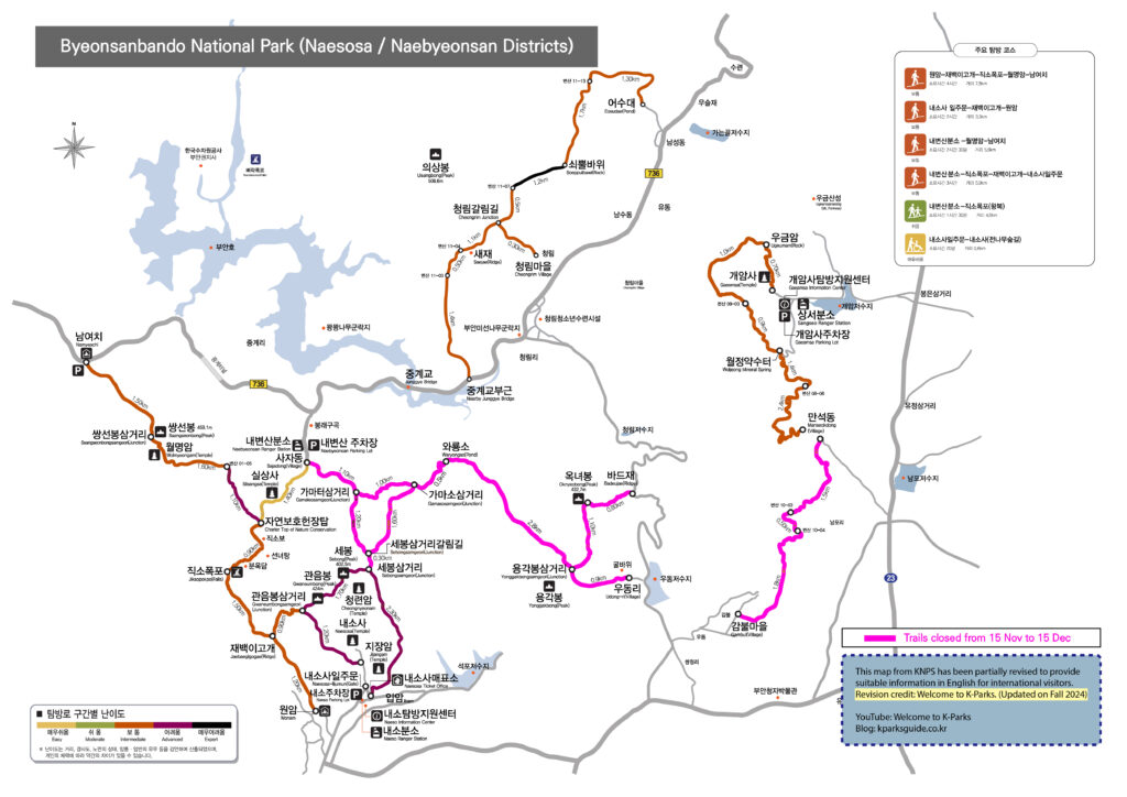
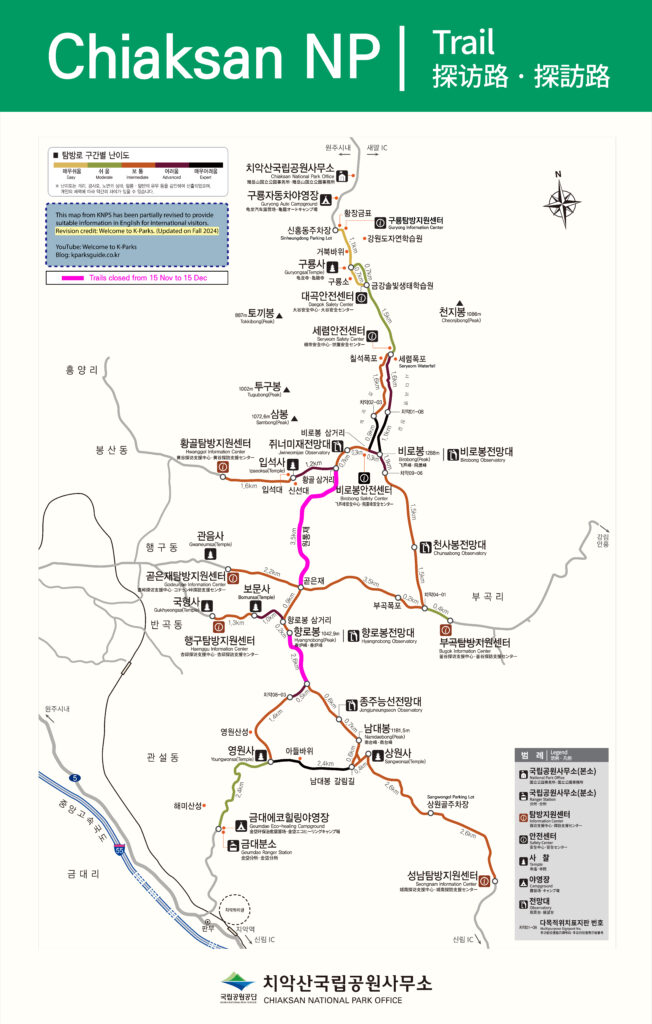
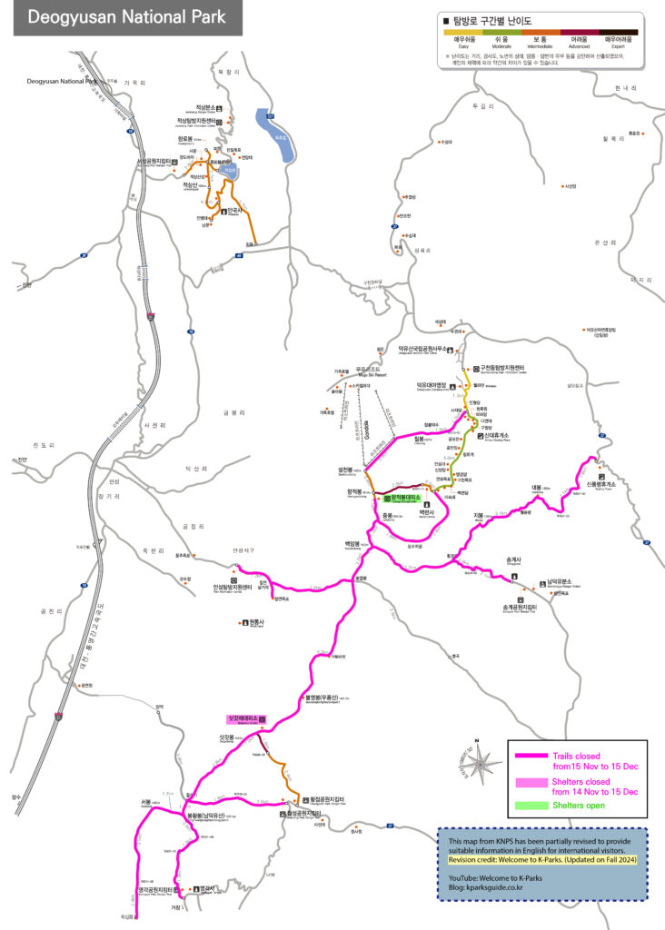
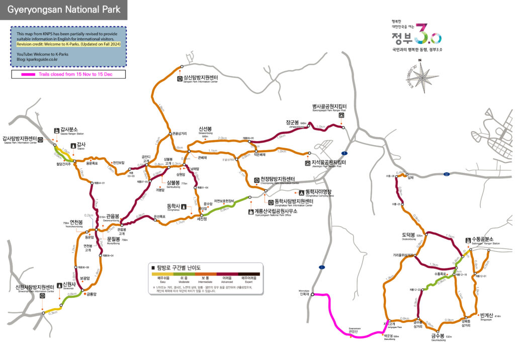
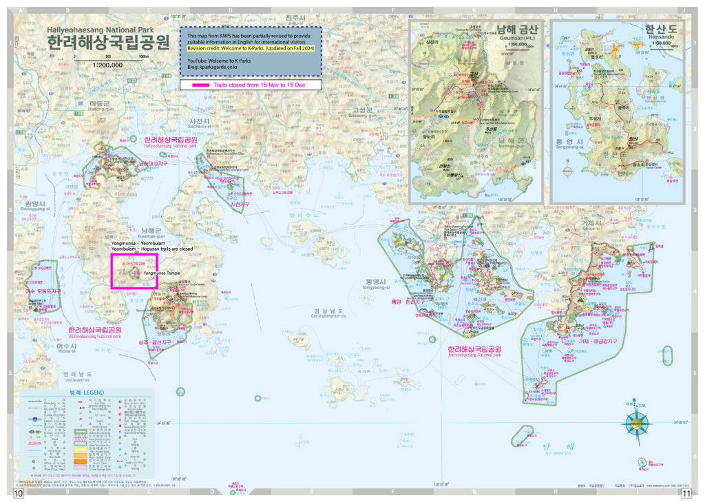
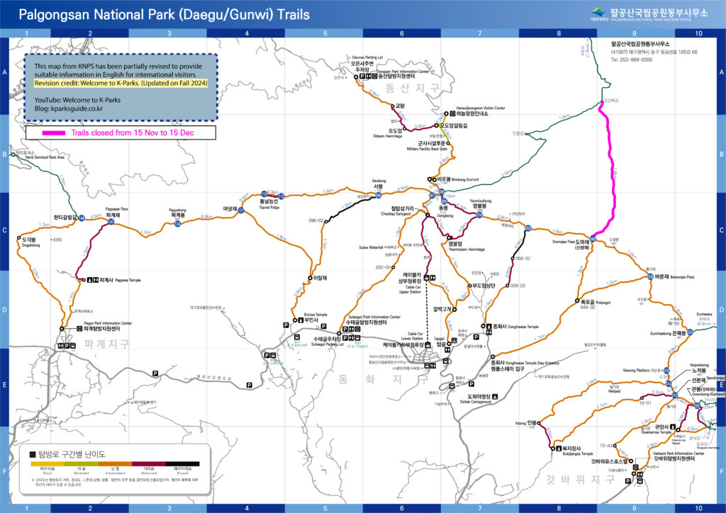
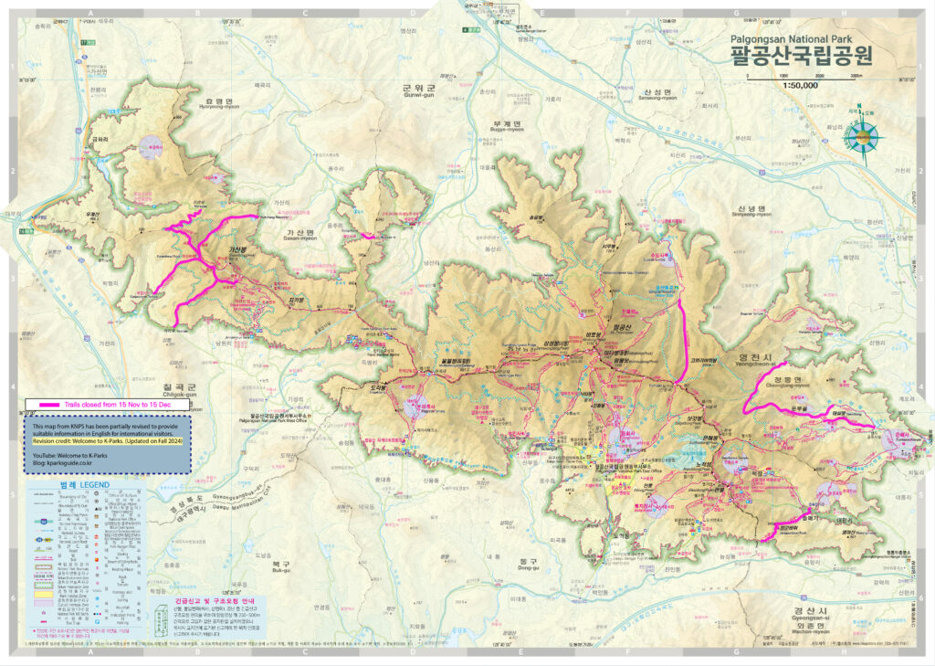
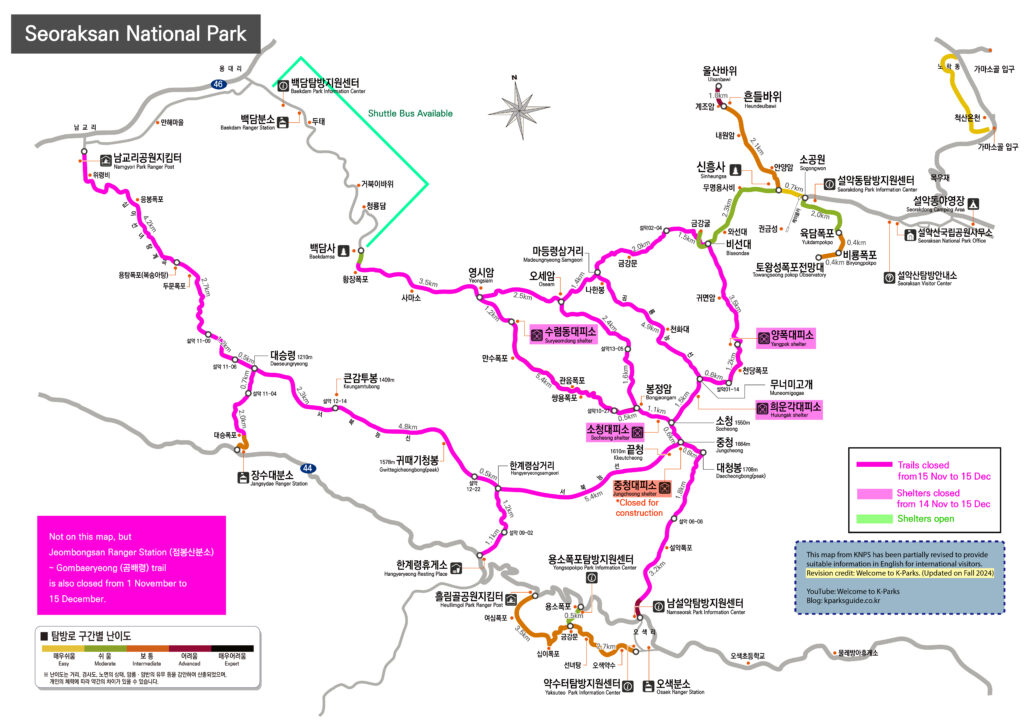
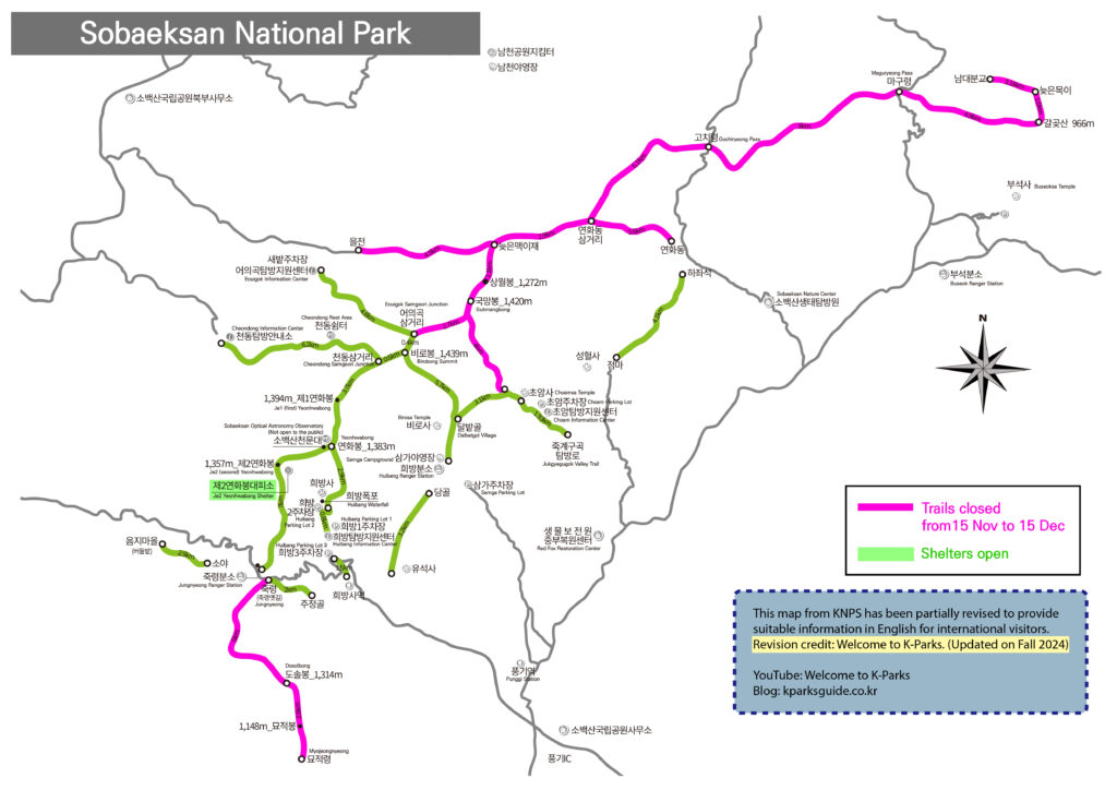
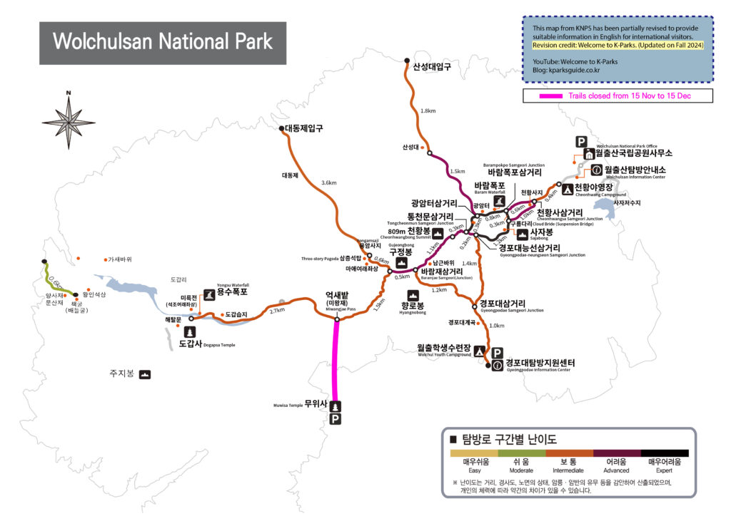
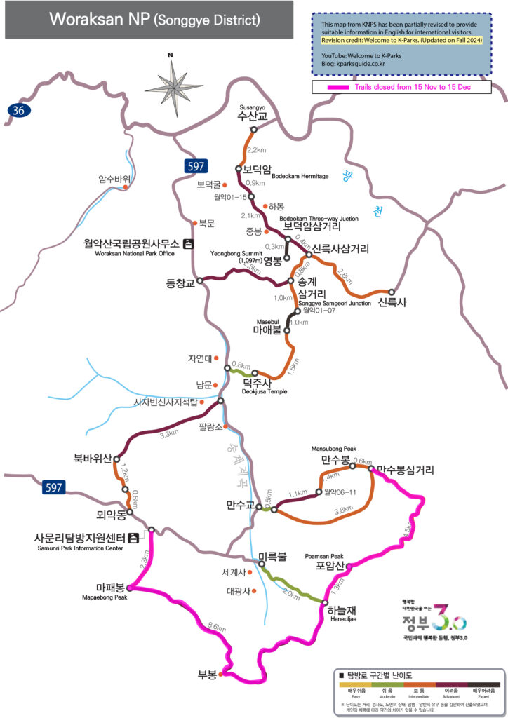
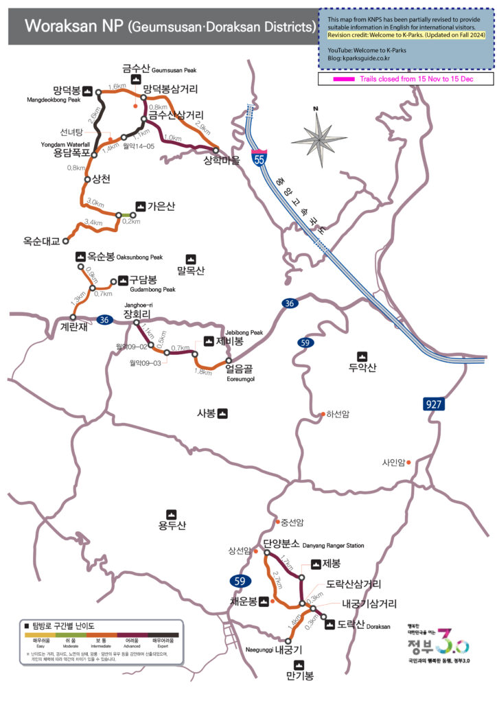
4) Maps for fall trail closure
If you plan to hike national parks during this period, those maps would be very helpful. But please be aware that the maps are primarily designed in Korean, with English translations provided in smaller text. Please zoom in to read the waypoint names in English. Note that the translations may not be entirely accurate.
Anyone who enters a restricted trail without permission is subject to a fine of up to 500,000 won in accordance with Article 86 of the Natural Parks Act.
Related phone numbers
1330: Korea Travel Hotline of Korea Tourism Organization(KTO) 1670-9201: Call Center of Korea National Park Service(KNPS)
Email inquiries: csnp@knps.or.kr
Before we start to talk about Manmulsang trail in Gayasan national park, let’s get into the highlights of the park first.
♦ Three Highlights of Gayasan National Park
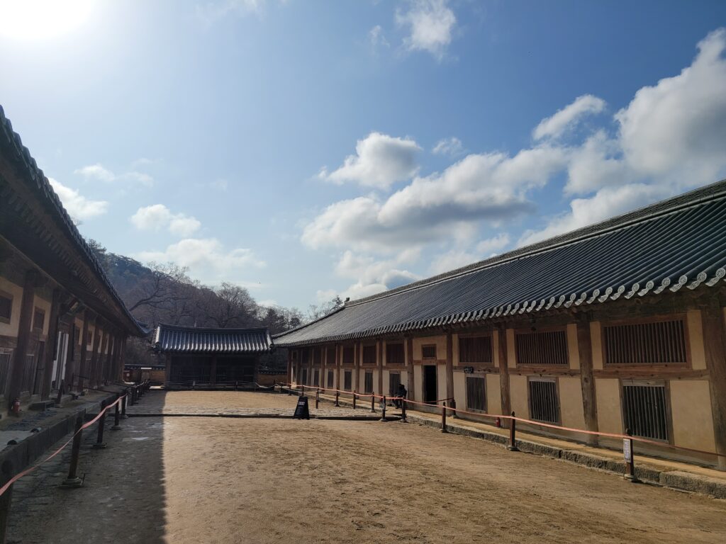
1. Haeinsa temple(해인사) and Tripitaka Koreana(팔만대장경)
Gayasan is most well-known for both Haeinsa temple, which is one of the top-three temples in Korea, and its Palmandaejanggyeong(Tripitaka Koreana, Buddist Scriptures) which is Memory of the World(세계기록유산). Also the building named Janggyeongpanjeon storing Palmandaejanggyeong is listed on world heritage site too.
Even though Gayasan was selected as one of the eight scenic views of the Joseon dynasty(late 14C~early 20C), since Haeinsa and Palmandaejanggyeong are too famous, the natural beauty of Gayasan has been relatively undervalued.
Janggyeongpanjeon in Haeinsa, which is the storage of Tripitaka Koreana
2. Manmulsang trail
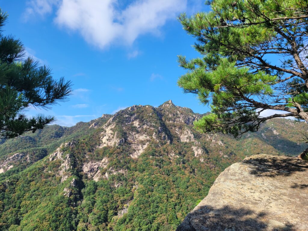
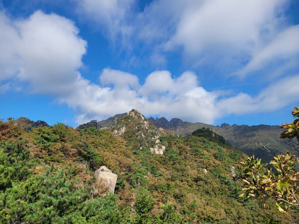
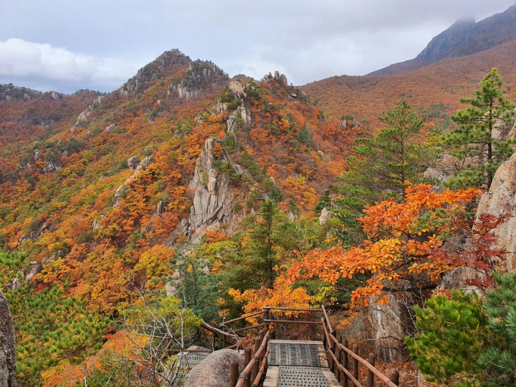
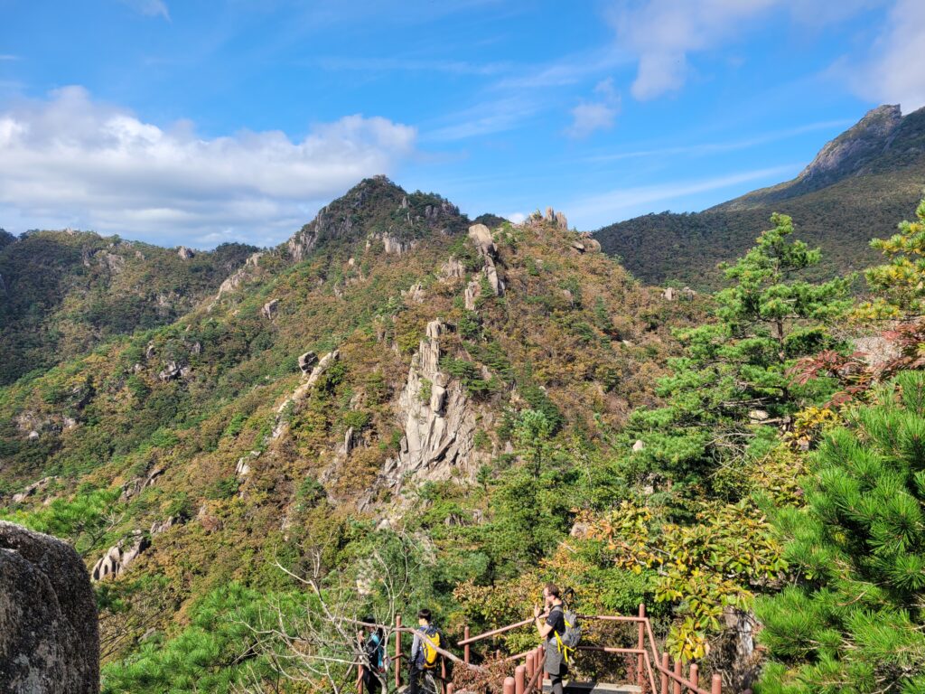
The most beautiful trail of Gayasan in general is Manmulsang trail which was named after Geomgangsan Manmulsang that is considered as the most spectacular trail in the whole Korea peninsula. Manmulsang literally means 10,000 rock formations.
Manmulsang in autumn foliage season(23.10.2019)
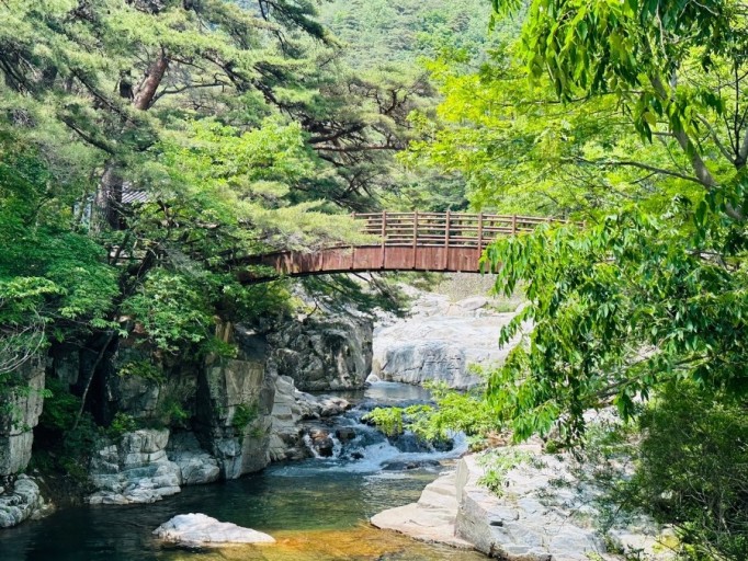
3. Sori-gil trail (a trail along with Hongyudong valley)
Hongyudong valley is one of the top scenic attractions in the region. Several years ago, Sori-gil trail along the Hongyudong valley was constructed which is 7km long. If you don’t want a strenuous hike, this trail would be a great option.
Sori-gil trail along with Hongyudong valley
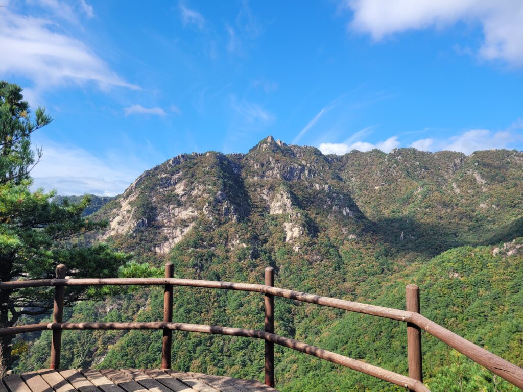
♦ Features of the Manmulsang trail in Gayasan (Baegundong~Manmulsang~Baegundong)
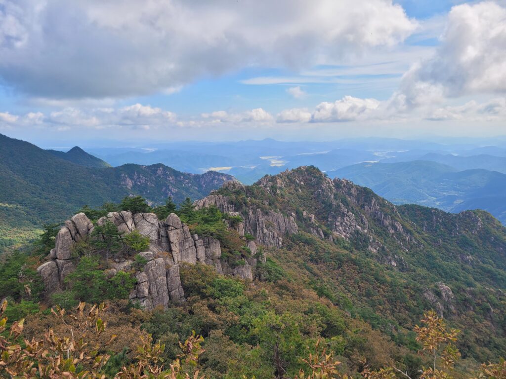
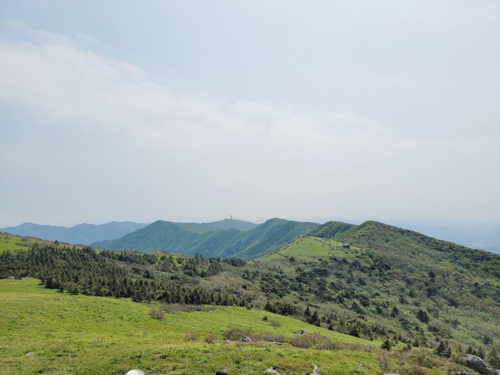
One of the best rocky vistas in the region
If needed, you can extend the route up to the summit, Chilbulbong and Sangwangbong.
Gayasan National Park is too famous for Haeinsa temple which stores Tripitaka Koreana(a wooden printing blocks). Then the beauty of the hiking trails in the park has been undervalued. Manmulsang trail is the highlight of the trails. If you like rocky vista, this trails is a MUST-GO trail.
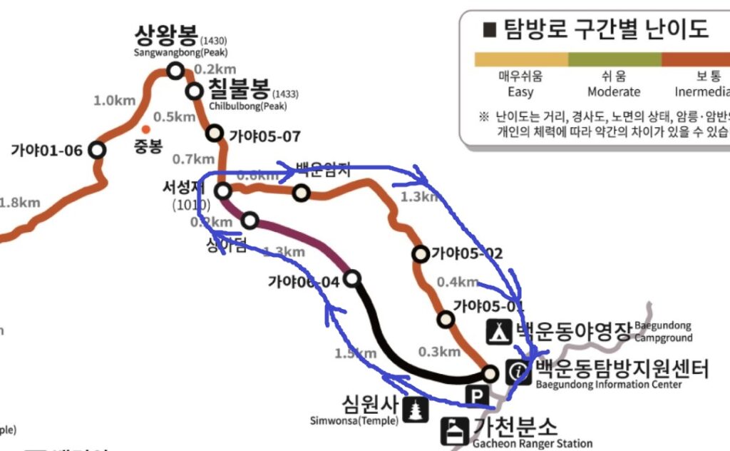
Course Summary: Baegundong Parking Lot -> Manmulsang -> Sangadeum Viewing Platform -> Seoseongjae -> Baegundong Parking Lot
Total Lenth: 6.9km
Duration: 4 hours and 30 minutes
Location of Gayasan national park.Manmulsang trail
1. Going up to the peak
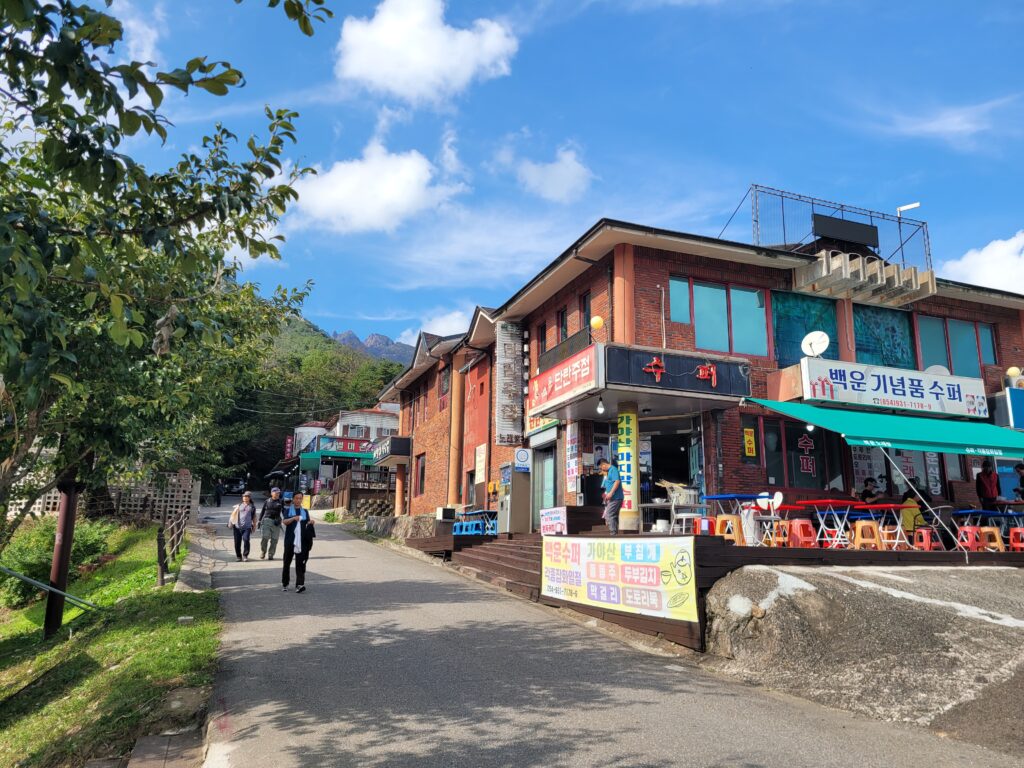
There is a big parking lot named Baegundong parking lot. You start your hike here however you come.
Baegundong Parking Lot
Right next to the parking lot, there are several local restaurants.
Restaurants in Baegundong
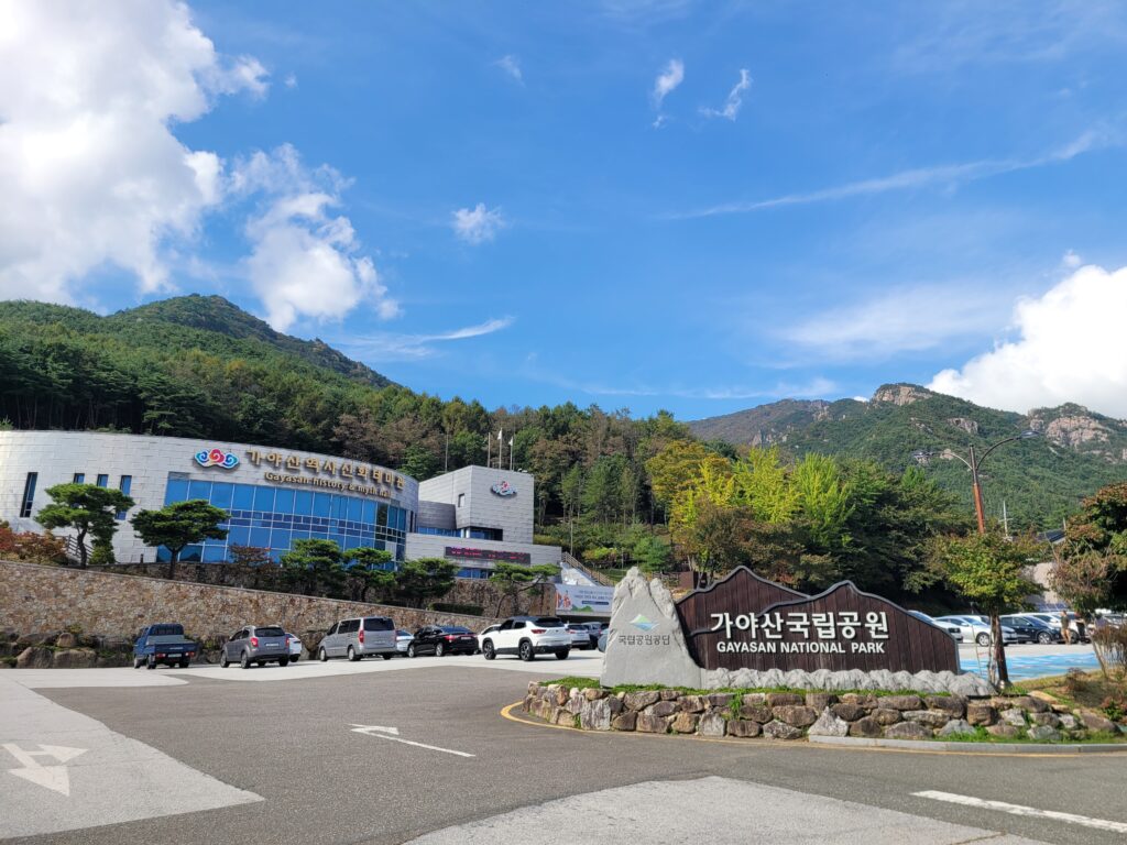
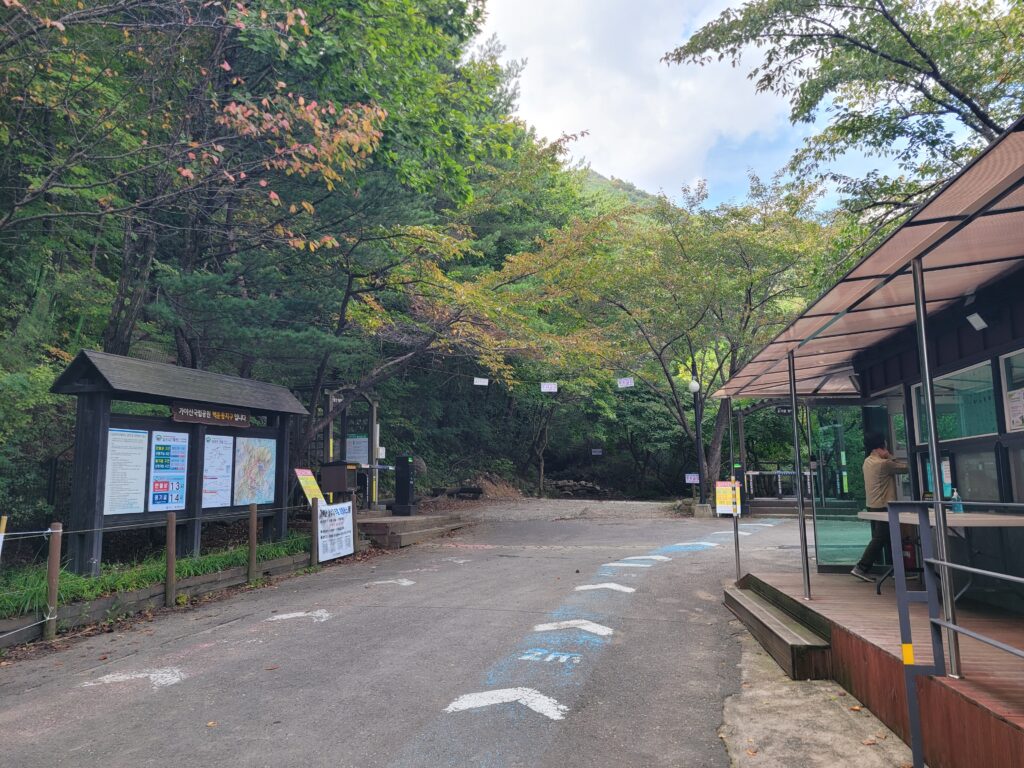
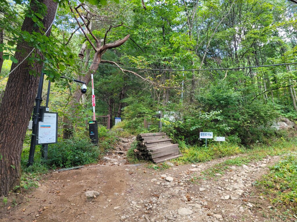
After a few hundred meters past restaurants and the Gayasan Wildflower Botanical Garden, you come to the Baegundong Information Center and the trailhead.
Baegundong Information Center Area / the Center on the right and the trailhead on the left.
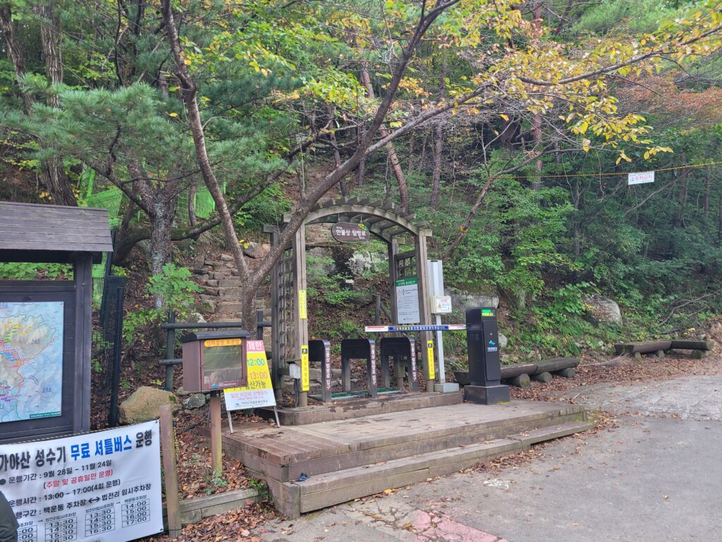
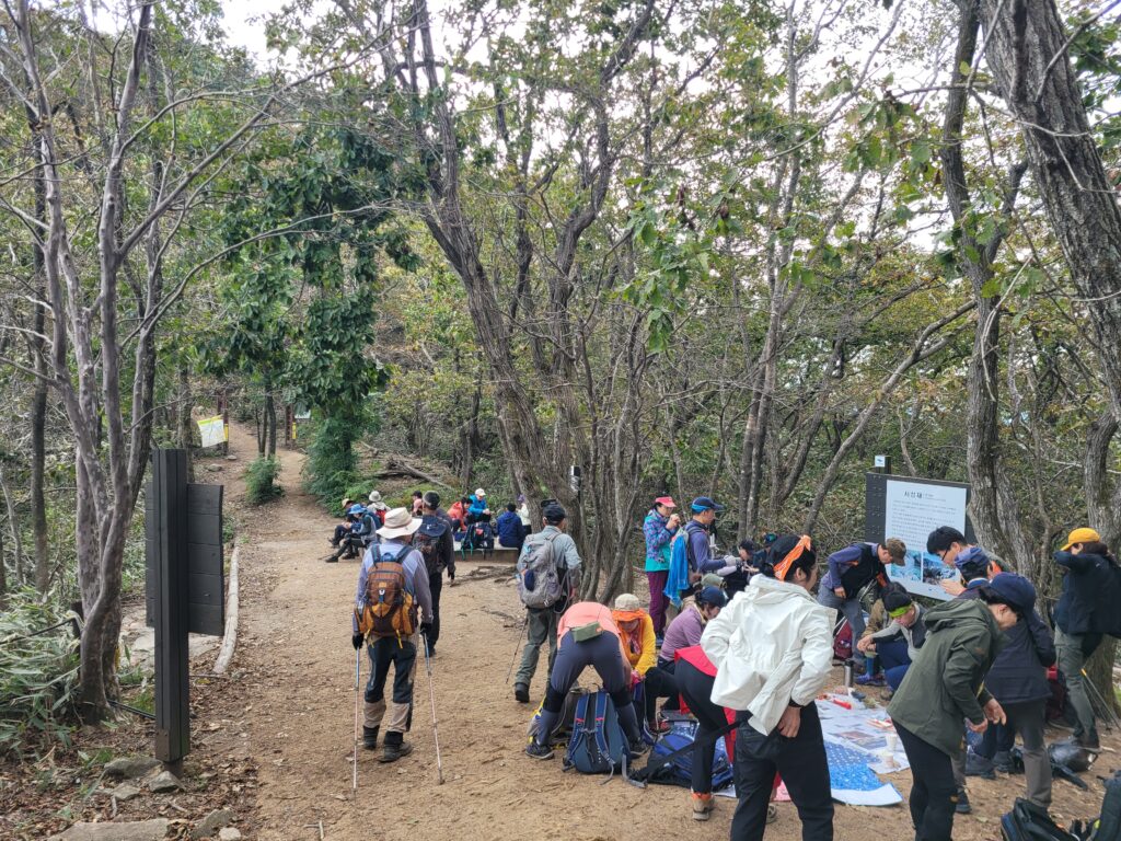
This is the entrance for the Manmulsang trail. Between September 1st and October 31st, advanced reservation is required for this trail. Unfortunately online reservation system is only possible in Korean. Then you can make a reservation by call(1670-9201) or email(csnp@knps.or.kr). If the reservation quota hasn’t been fully occupied on the day of hiking, on-site reservation could be possible.
the trailhead for Manmulsang
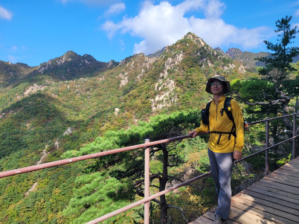
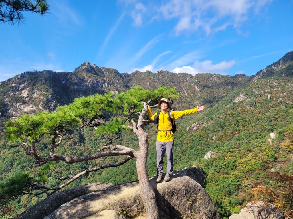
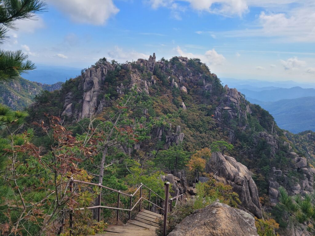
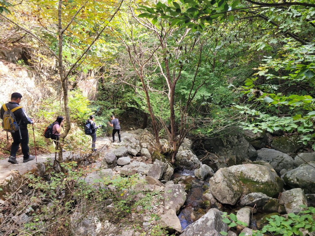
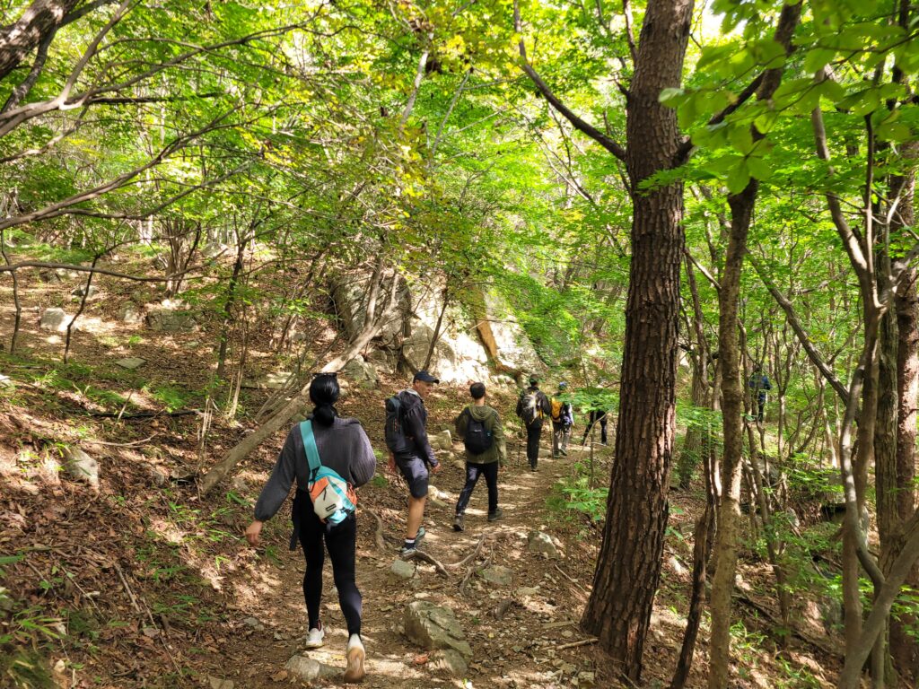
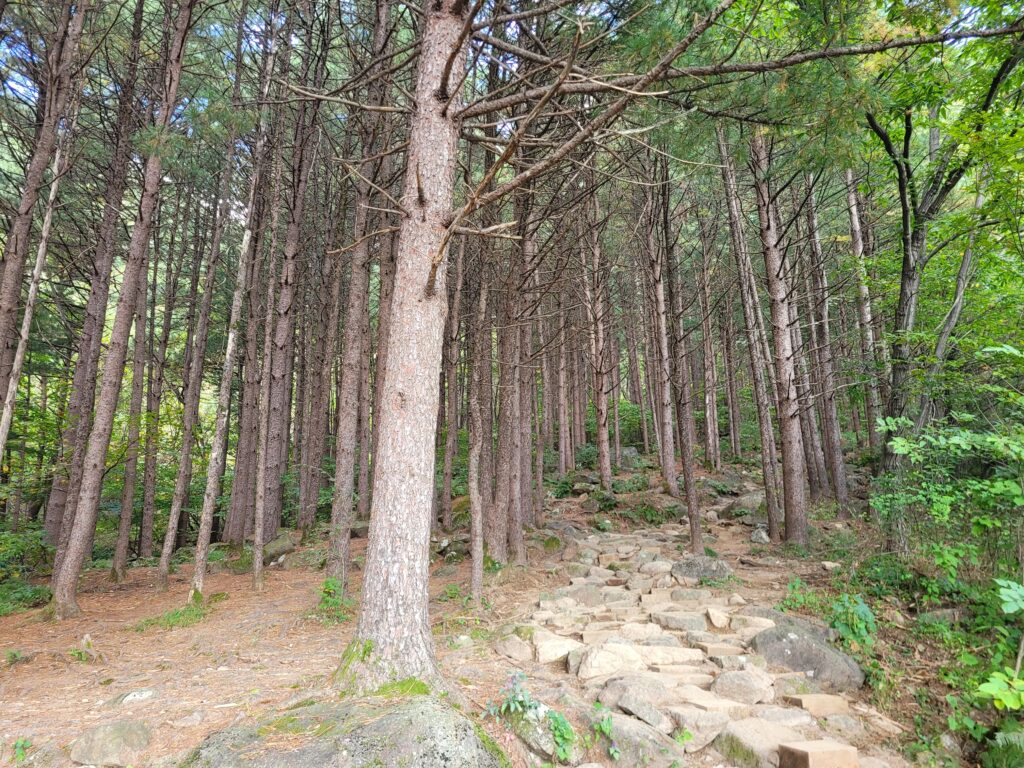
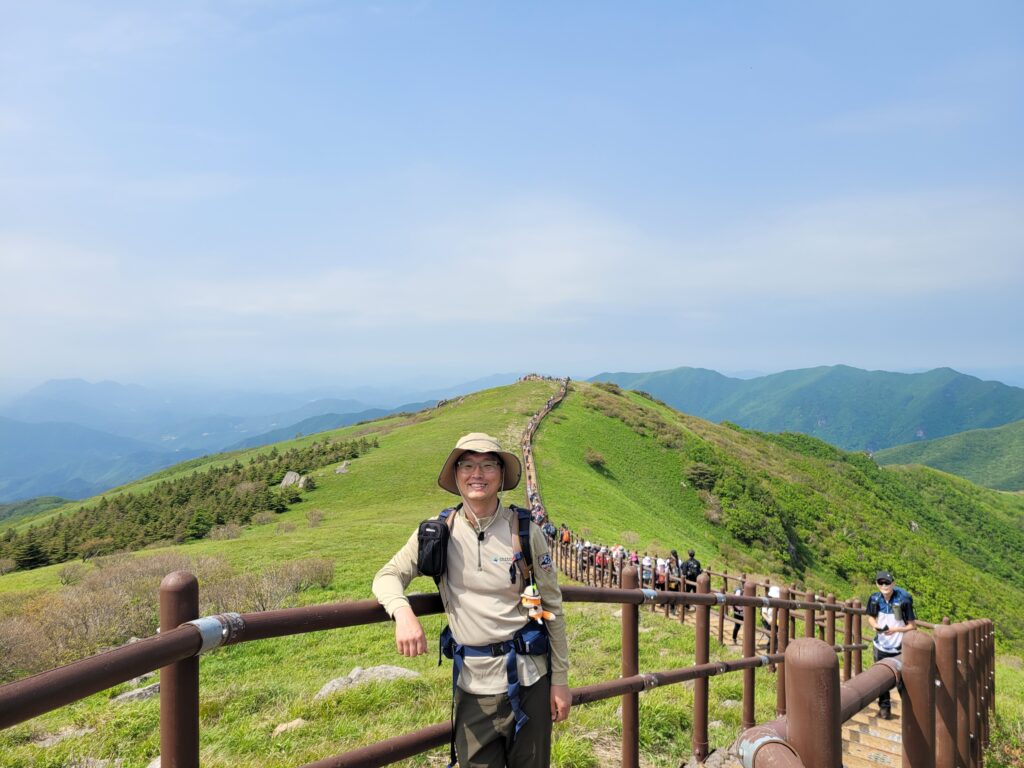
Now it is time to start real hiking. As soon as you start, it is very strenuous. But after an hour, the ridge hike continues and it is very rewarding for your effort.
taken on 9 Oct 2024
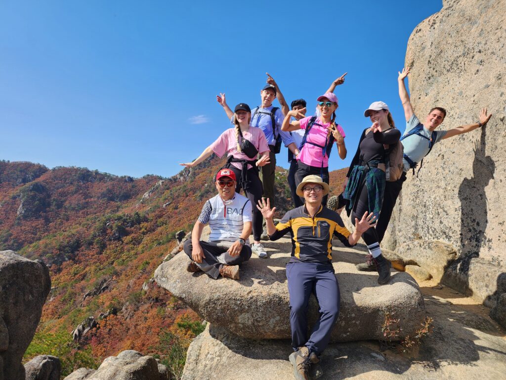
First viewing platform (9.Oct.2024)Pine tree spot on Manmulsang trail (9.Oct.2024)taken on 23 Oct in 2019ENP hiking group at a photo spot in Manmulsang trail (14.Oct.2022)ENP group hiking (14.Oct.2022)
Pictures taken along the way toward Sangadeum (9.Oct.2024)
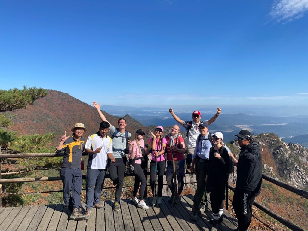
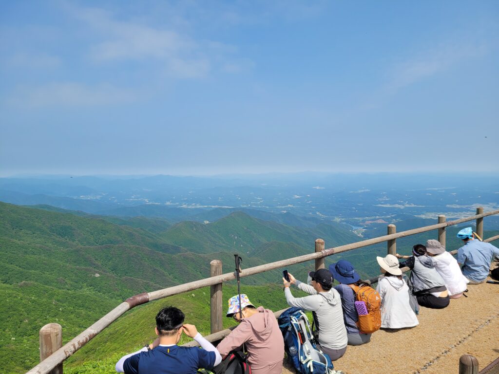
2. On the peak (Sangadeum)
ENP hiking group photo at Sangadeom Viewing Platform (14.Oct.2022)
After Sangadeom viewing platform, it is only an easy 400m walk to Seoseongjae rest area.
Seoseongjae Rest Area
3. Coming down back to the trailhead
Then it is easy to come down back to the trailhead. If you still have enough energy to add extra two hours hike, it would be a good idea to continue your hike to Chilbulbong and Sangwangbong, the summit of the park.
Yonggigol valley trail to come down (9.Oct.2024.)
♦ How to get here? (Transportation)
⇒ By Car (Parking lot address)
Address: 가야산국립공원 백운동지구주차장(Baegundong parking lot) / 경북 성주군 가야산식물원길 17
QR code for Baegundong parking lot
⇒ By public transportation
From Seoul,
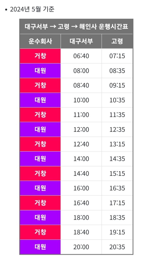
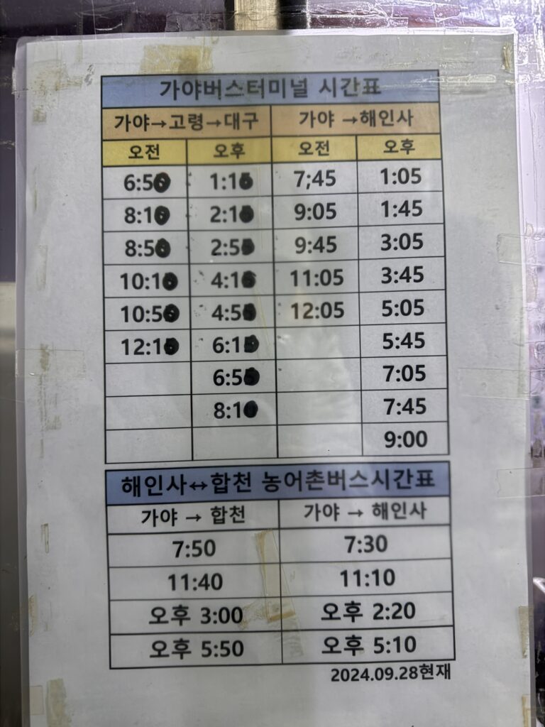
Seoul -> Dong-Daegu Station -> Daegu Seobu Bus Terminal -> Haeinsa Intercity Bus Terminal
It takes about 25 minutues from Dong-Daegu Station to Seobu Bus Terminal by subway. After you get on a bus at Seobu Terminal toward Haeinsa, you need to get off the bus at Gaya Bus Stop which is about 15 minutes before Haeinsa. Lastly you need to grab a taxi to Baegundong parking lot which would cost around 12,000won taking 15 minutes.
Route: Seobu Bus Terminal -> Goryeong Bus Terminal -> Gaya Bus Stop -> Haeinsa temple
Frequency: Total 14 buses per day for each way
Fare: 7,500won for adult
Journey: around 1hour and 10 minutes
Gaya Bus Stopbus time table from Daegu Seobu terminal to Haeinsabus time table from Gaya Bus Stop to Daegu Seobu terminal
Phone Number for Taxi: 010-6688-2044
Ok. This is all for Manmulsang trail. Hope that this helps you find your way to get to this trail.
If you want to watch a video clip about this trail, please wait for a week. A video clip is on its way. I will share it here soon.
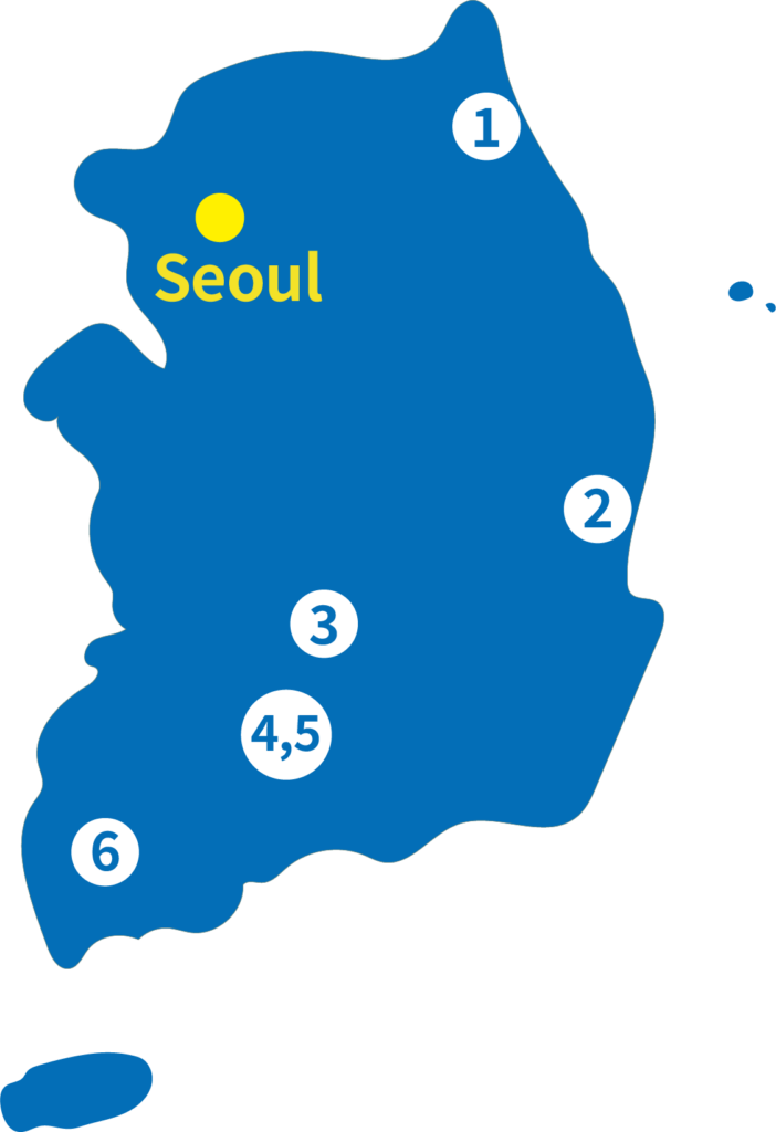
If you prefer to shop in person, here are the visitor centers where KNP merchandise is available. Click on the links below to access directions through Naver Map.
Note: Visitor Centers are closed every Monday.
The list of Visitor CentersThe location of Visitor Centers
Seoraksan Visitor Center: https://naver.me/5s9yHm83 As of 14 October 2024, this visitor center is temporarily closed for construction. Please visit the Seorakdong Information Center instead: Seorakdong Information Center: https://naver.me/xpPZLlMa
♦ Three Highlights of Sobaeksan National Park trails
1. Ridge hiking
Sobaeksan trails have a unique landscape compared with other mountain type national parks. This mountain is made of dirt then it has very nice gentle slope at the top while others are relatively very rocky. Then it has its nickname, Korean Alps.
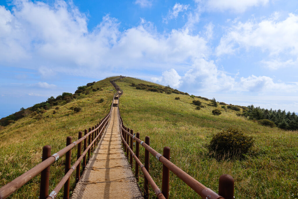
Ridge line near the summit, Birobong
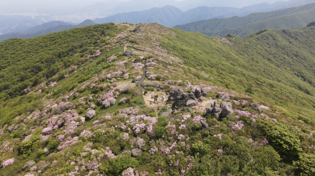
2. Royal Azalea Habitat
Between end of May and beginning of June, Royal Azaleas at the top of Sobaeksan are in full bloom. Around this time, there is Royal Azalea Festival in both regions, Yeongju and Danyang. The color of the flower is light pink, which is different from others. Walking along between those flowers is a unique experience.
Royal Azalea in Sobaeksan
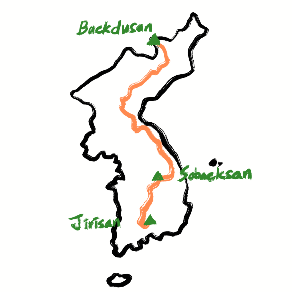
3. Baekdudaegan Range
If you are avid hikers, you would’ve heard the name of Baekdudaegan many times, the spine of Korean peninsula mountain range. It spans 1,400km from north Korea to South Korea. Among them, Sobaeksan has the longest part of 40km which make Sobaeksan the center of Baekdudaegan.
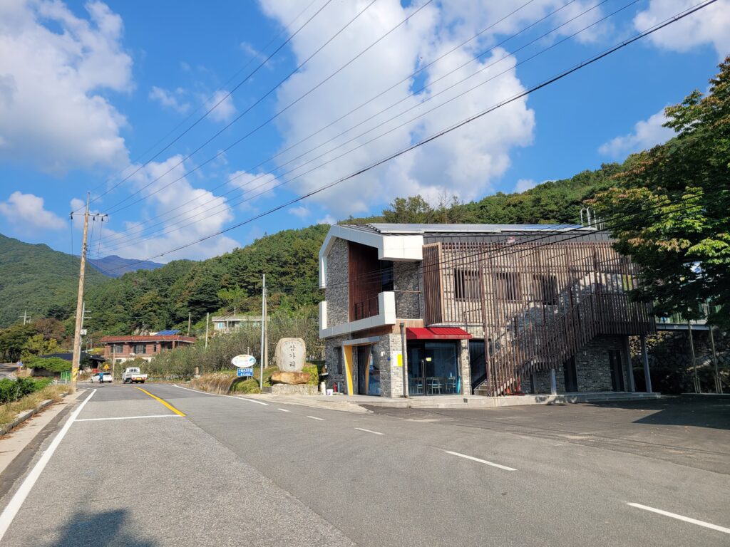
The most popular one among Sobaeksan trails in Yeongju side
♦ Trail Introduction
There are several trails which lead to the summit, today I am going to introduce the shortest way up to the summit, Birobong, of Sobaeksan National Park.
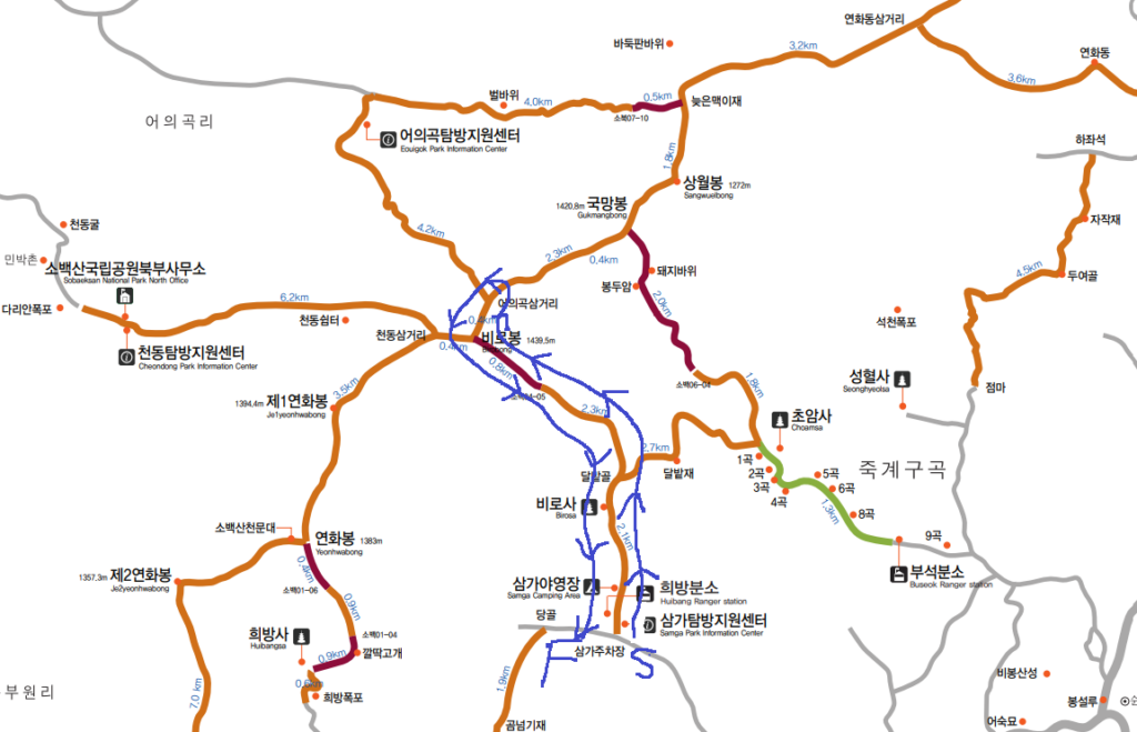
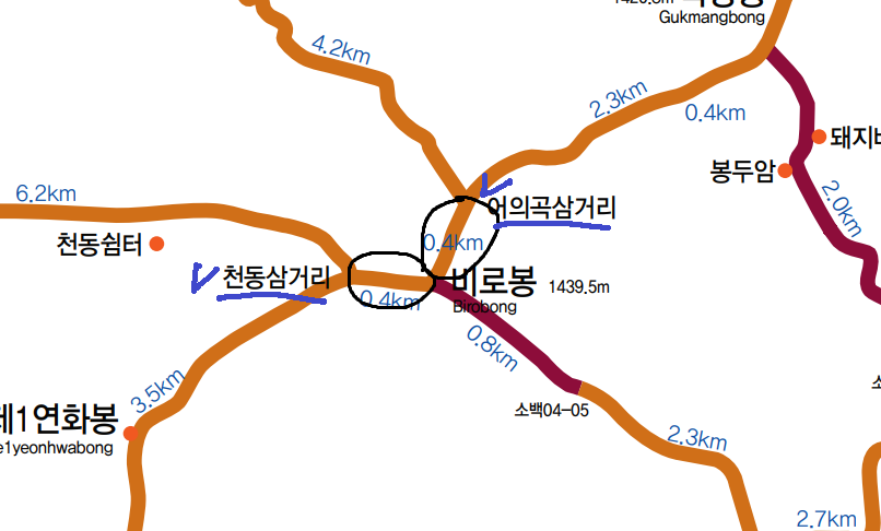
Course Summary: Samga Parking Lot -> Dalbatgol Village -> Birobong -> Eouigok Three-way junction -> Return to the starting point
Total Lenth: 11km
Duration: around 5 hours
Samga~Birobong trail map
If you come by bus, you have to start a few hundred meters down.
Bus stop in Samgadong
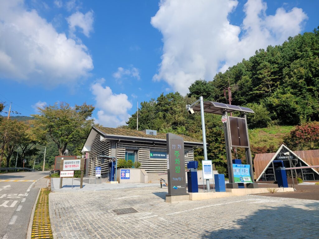
If you walk up along the road, you will see the parking lot.
Entrance of Samga parking lotSamga parking lot
After the parking lot, you can keep going up along the road.
Road to Samga campground
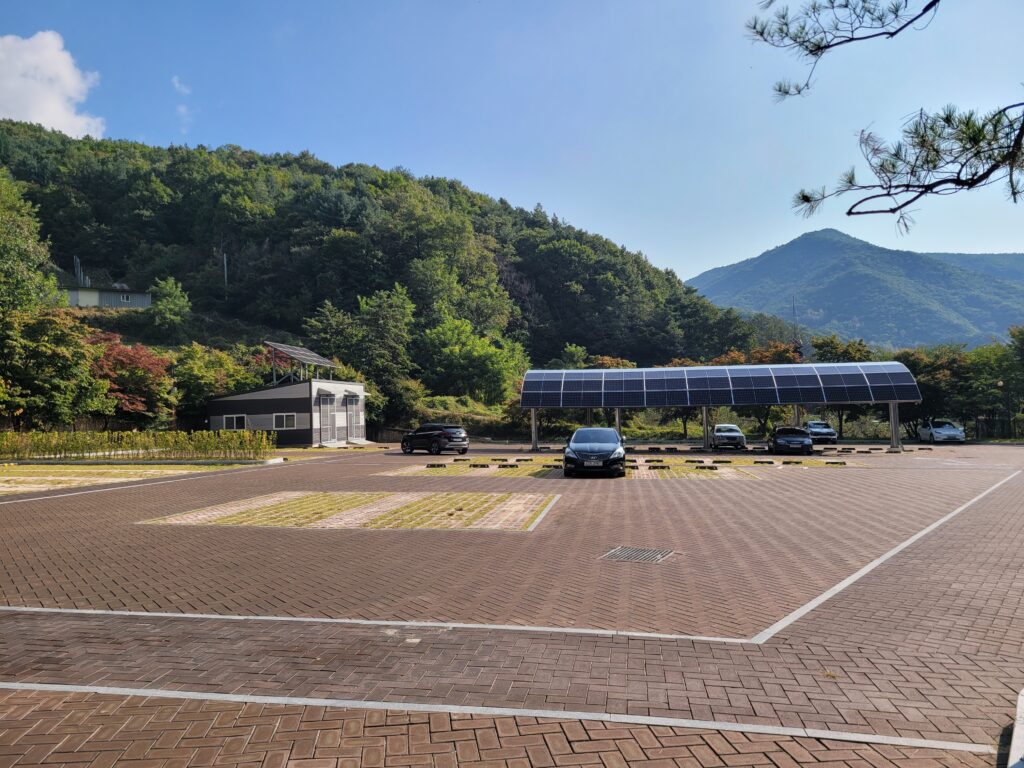
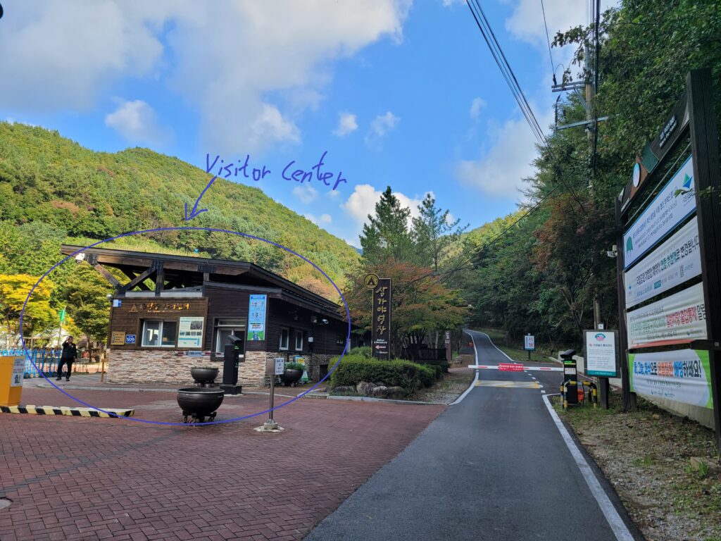
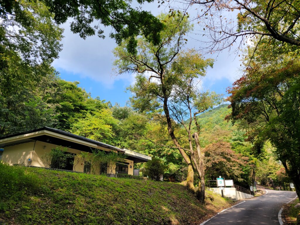
If you come up about 100m, you will see Samga Campground with a visitor center.
Visitor center at the campground
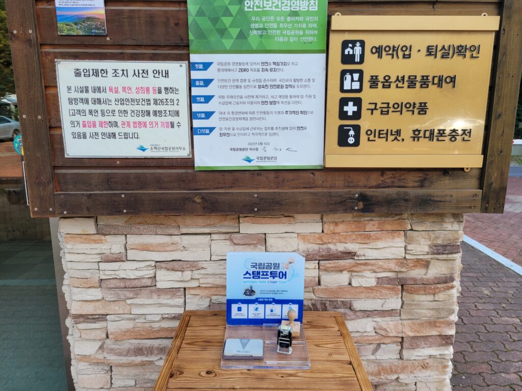
These days, national park passport stamp tour and KNPS goods are quite popular. Then, at this visitor center, you can purchase KNPS goods and get a stamp for your passport.
Stamp for national park passportKNPS goods at Samga campgroundSamga campground
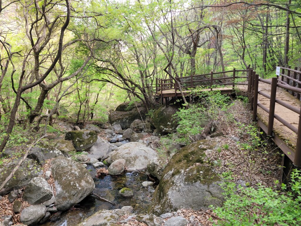
After you are done with it or not interested in those, you can keep going up along a nice stream. After passing Dalbatgol village, there is no stream or water. Then enjoy the sound of water flowing and walking along the stream.
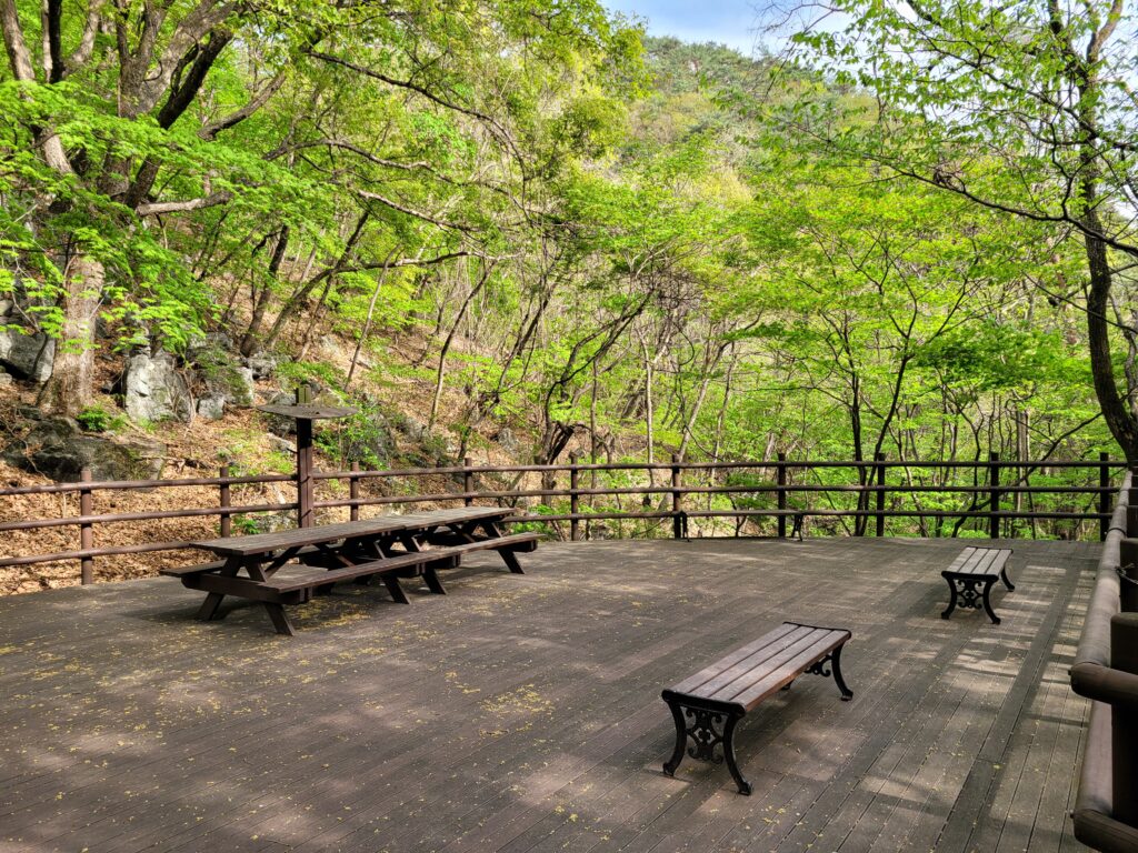
wooden deck along the streamRest Area
You will soon see the last restroom.
Last restroom on this trail
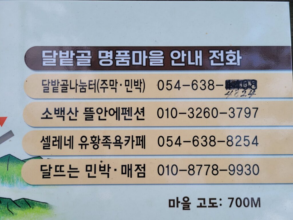
Then, finally you will see Dalbatgol village. Here is a tip. If you make a booking for any shop up here like restaurants or coffee shops, you can drive up here which can make your hike shortest way up. Here is the list of shops and contact in this village.
The list of shops
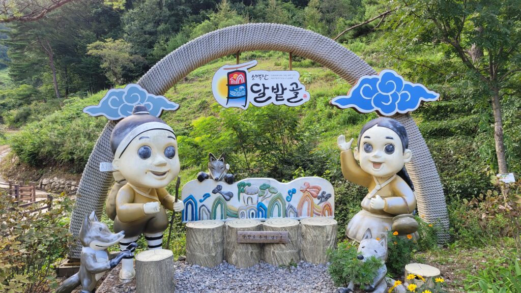
Landmark of Dalbatgol village
when you come back down, it would be a great idea to stop by this local restaurant to try Korean pan-cake and drink(Makgeolli).
Restaurant at Dalbatgol village
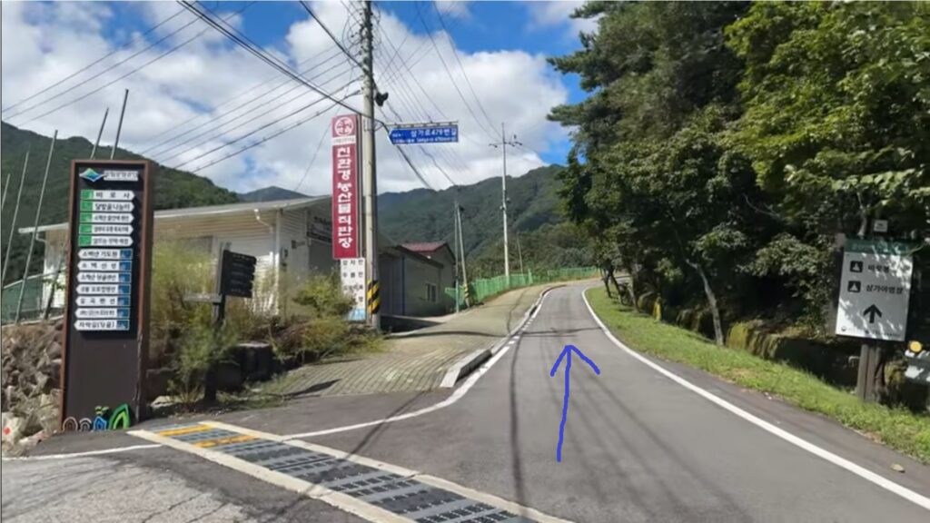
Keep going up and then shortly you will see the gate of the trail.
Trailhead of Samga trail
After passing the gate, there is only one way up then there is only little chance that you would lose your way. Please feel safe but get ready because this trail is fairly steep due to the shortest way up to the summit.
After a few minutes, you encounter a nice fir forest, which is one of my favorite section of the trail.
Fir forest
After a dozen of minitues, you will see a rest area. It would be better to take a break here because there is no more proper rest area for the next one hour.
Rest Area at Samga trail
From now on, there is not much special things, only a path until just below the summit.
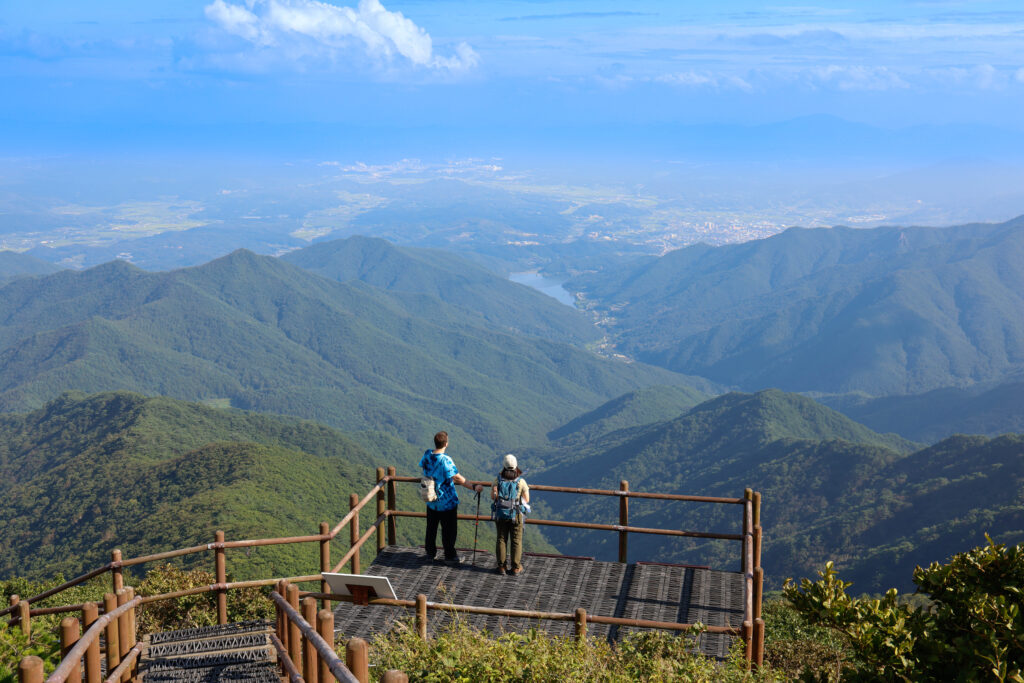
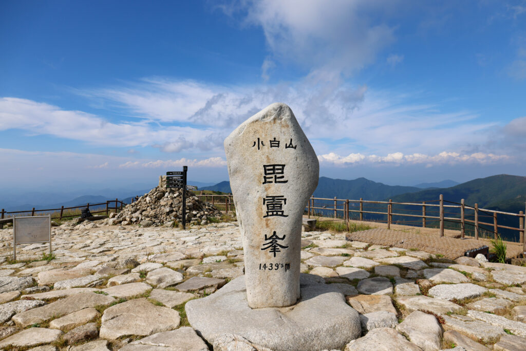
After another one and half or two hours, you are likely to reach the summit, Birobong. Just a few minutes before the summit, the sky starts to show up. The exclamation comes out of its own accord.
Now finally it’s time to enjoy the 360° panoramic view.
Viewing platform Just below the summitBirobong Summit StoneToward Oeuigok Samgeori / it’s me,Hong.Lily, a team-mate, from K-Parks Exploration Lab. She runs a Youtube channel “Welcome to K-Parks”.Toward Birobong from Oeigok samgeoriHikers enjoying the view at Birobong areaToward Cheondong Samgeori
Here is a ranger’s tip. Most people finish their hike as soon as they reach the summit. But I strongly recommend you to go to either Oeigok samgeori or Cheondong samgeori since those section as below is the main highlight of the park.
Birobong section
♦ How to get here? (Transportation)
⇒ By Car (Parking lot address)
Address: 경북 영주시 풍기읍 삼가로 509
QR code for Samga parking lot
If you grab a taxi at Punggi station or Punggi bus terminal, it would cost about 10,000won or 15,000won respectively. But if you like, you can go up all the way to Dalbatgol village with extra 2,000~3,000won which would be a great option.
By public transportation
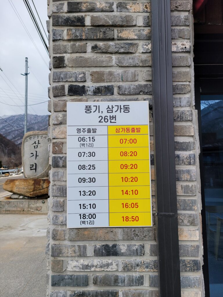
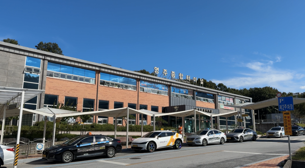
Route: Youngju bus terminal ⇔ Punggi station ⇔ Samgadong bus stop
Bus number: 26
Frequency: Total 7 buses per day for each way
Journey: around 50 minutes
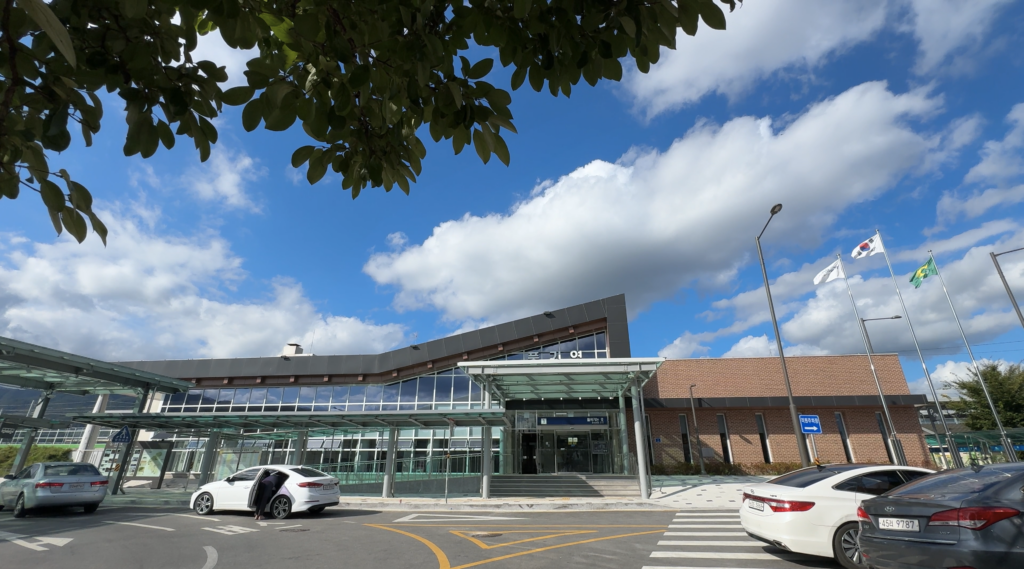
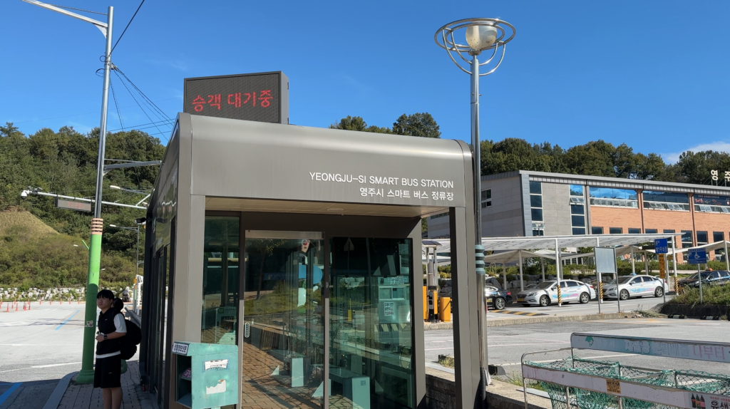
Bus time table at Samgadong bus stopPunggi stationBus stop at Punggi stationYeongju bus terminalBus stop at Yeongju bus terminal
Ok. This is all for Samga~Birobong trail. Hope that this helps you find your way to get to this trail.
If you want to watch a video clip about this trail, please check out the link as below.