
Trail Closure Policy for preventing wildfire
1) Purpose
Korea National Park Service(KNPS) carries out trail closure policy to prevent wild fires and protect the ecological environment during dry season.
2) Closed trails
Trail closure policy applies to about 121 sections (570km) within the entire national parks which account for around 20% of the total trails.
3) Closure Period
Trail closure policy during wildfire prevention period is conducted twice a year (spring and fall).
- Spring: February 15 ~ May 15
Detailed closure period varies on parks. Next year I will make a posting about Spring trail closure in details.
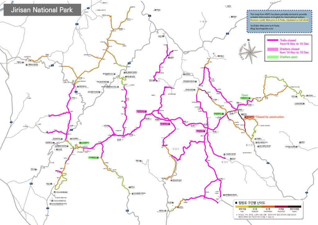
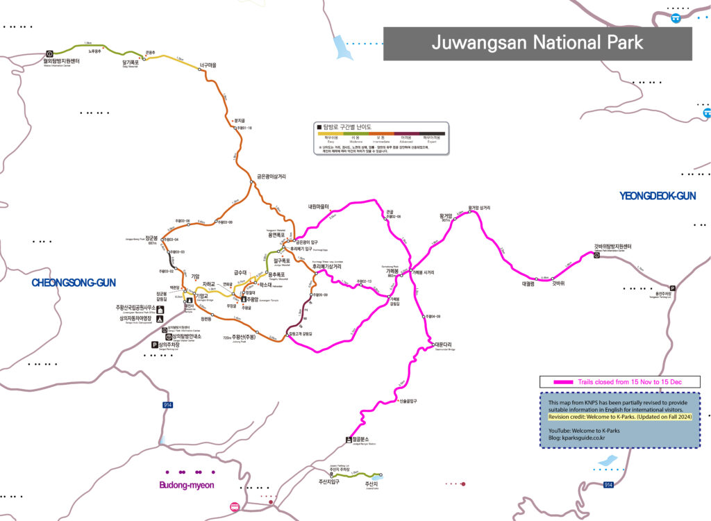
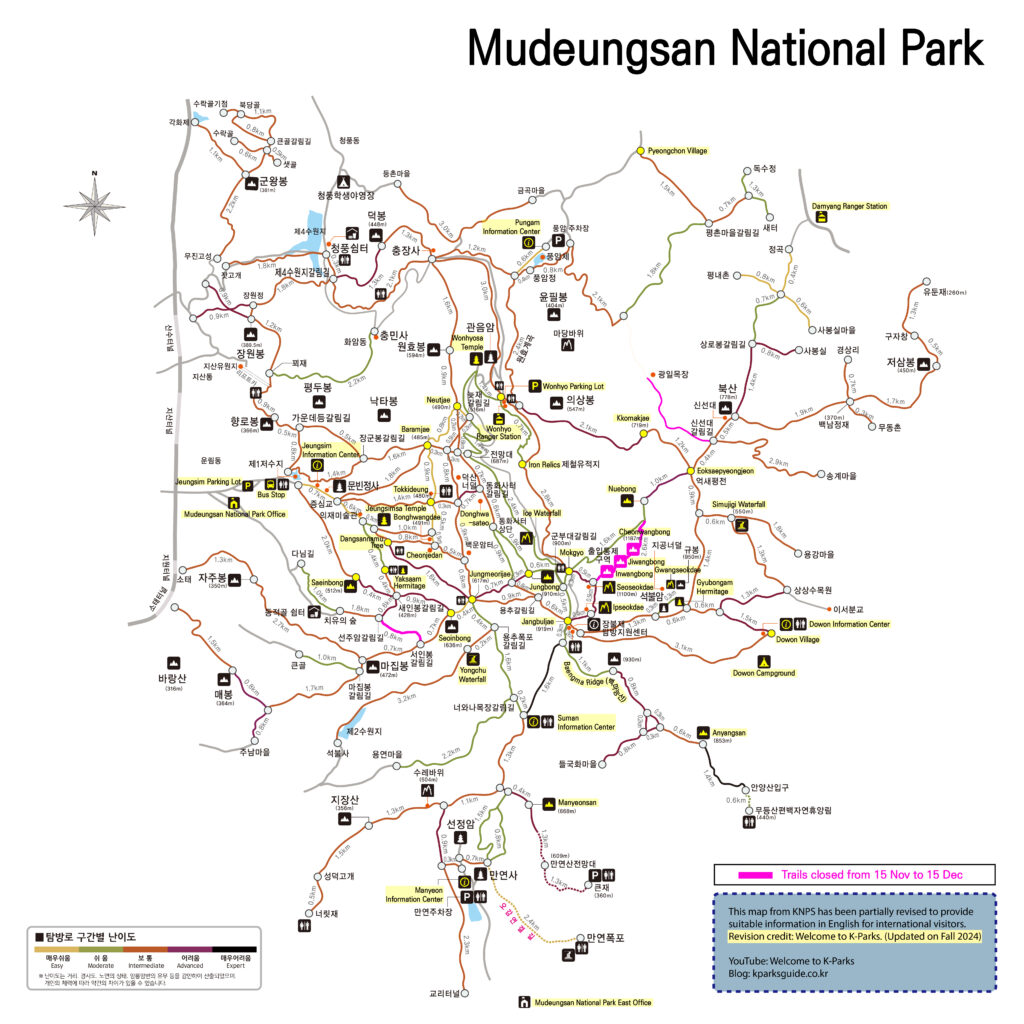
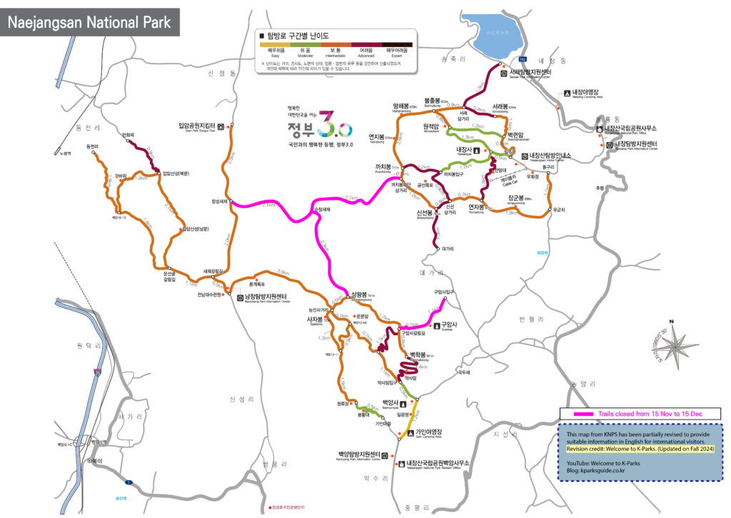
- Fall: November 15 ~ December 15
Closure period is almost fixed but applied parks are slightly different every year. For 2024, see below.
| Period | Park Names impacted by this closure policy |
| Nov.15.∼Dec.15.
(every year) |
18 national parks out of 23 parks.
(Except for Gyeongju, Hallasan, Gayasan, Dadohaehaesang, Taeanhaean) |
4) Maps for fall trail closure
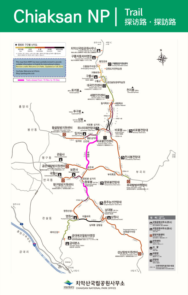
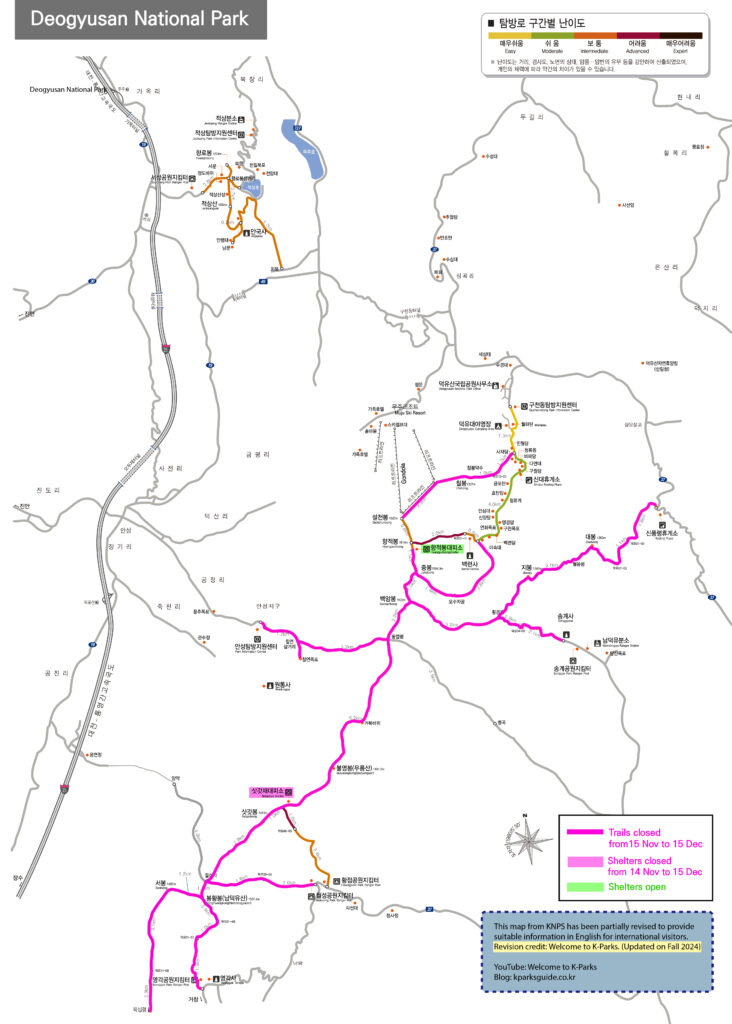
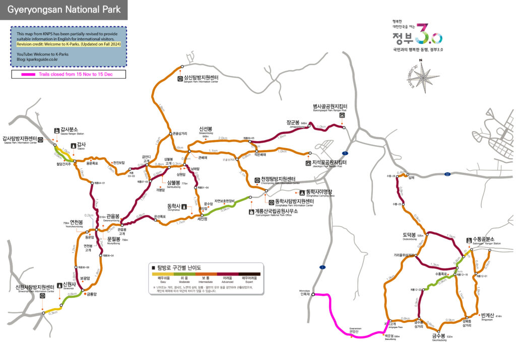
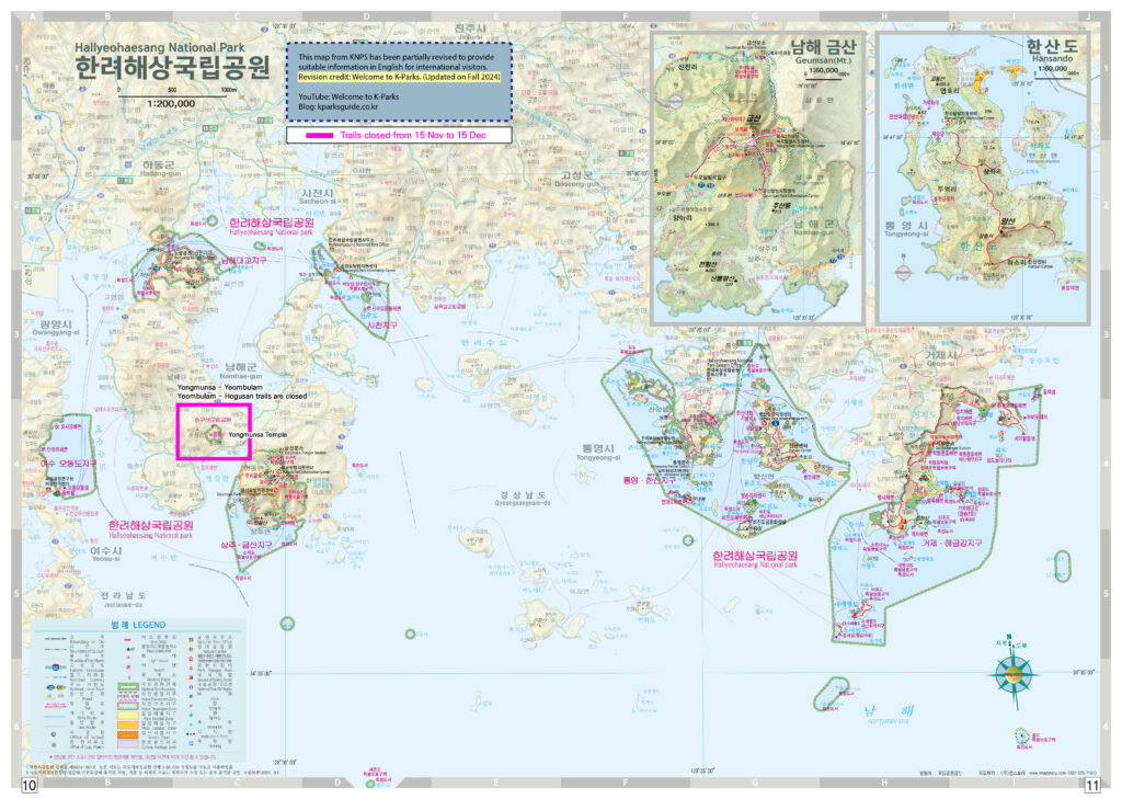
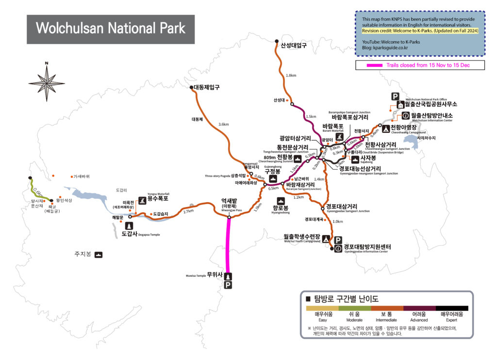
If you plan to hike national parks during this period, those maps would be very helpful. But please be aware that the maps are primarily designed in Korean, with English translations provided in smaller text. Please zoom in to read the waypoint names in English. Note that the translations may not be entirely accurate.
The map order is in ABC.
1. Bukhansan
- Baegundae area
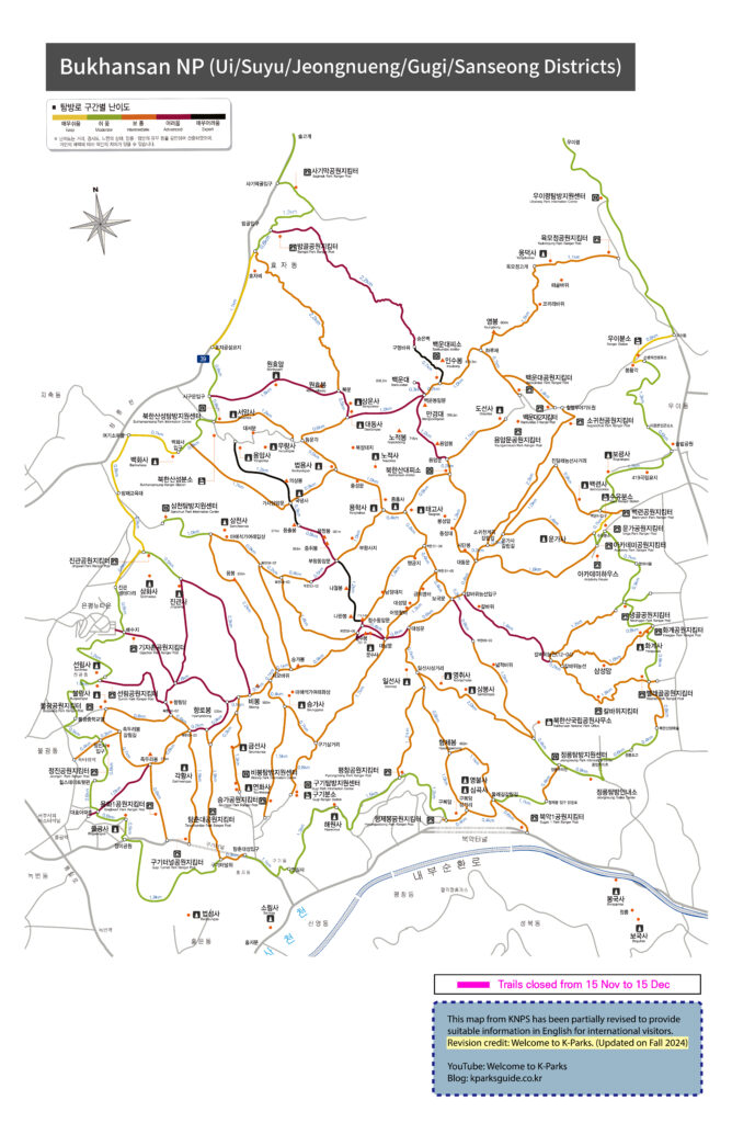
Bukhansan(Baegundae) Map download
- Dobongsan area
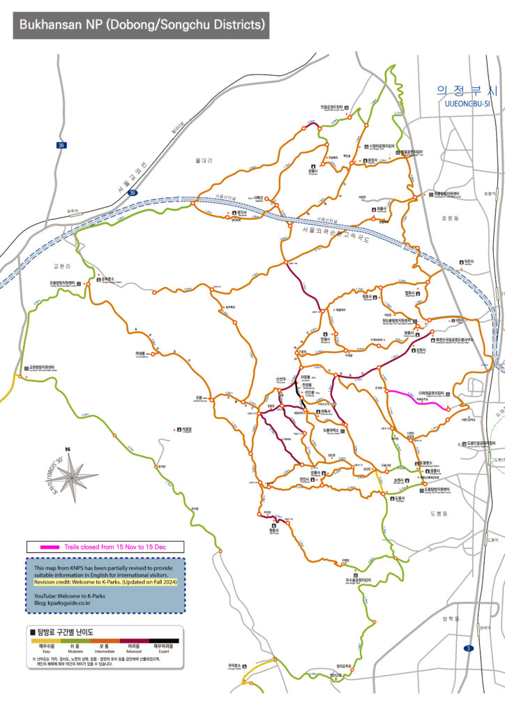
Bukhansan(Dobongsan) Map download
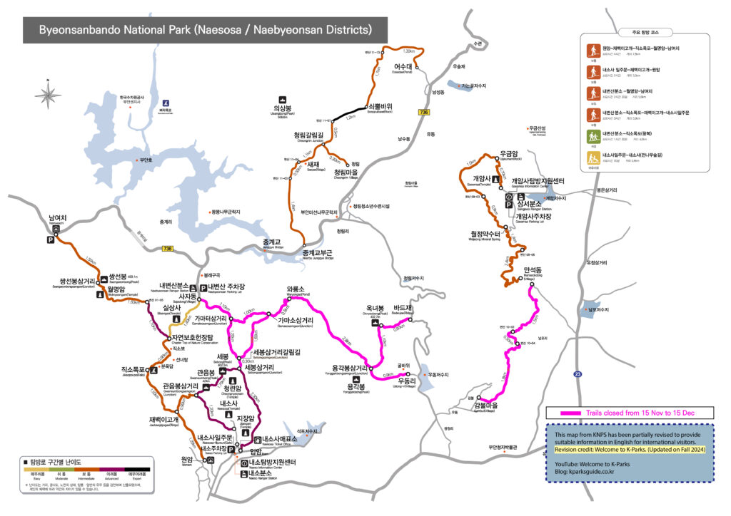
2. Byeonsanbando
3. Chiaksan
4. Deogyusan
5. Gyeryongsan
6. Hallyeohaesang
7. Jirisan
8. Juwangsan
9. Mudeungsan
10. Naejangsan
11. Odaesan

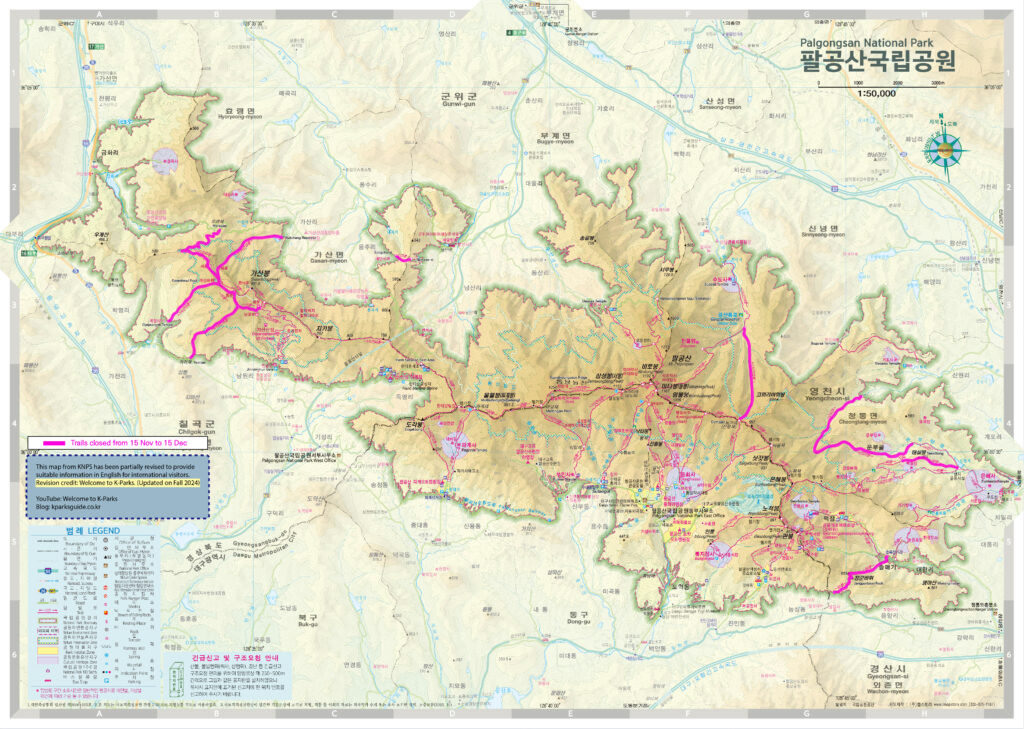
12. Palgongsan
- Palgongsan(Daegu-Gunwi area)
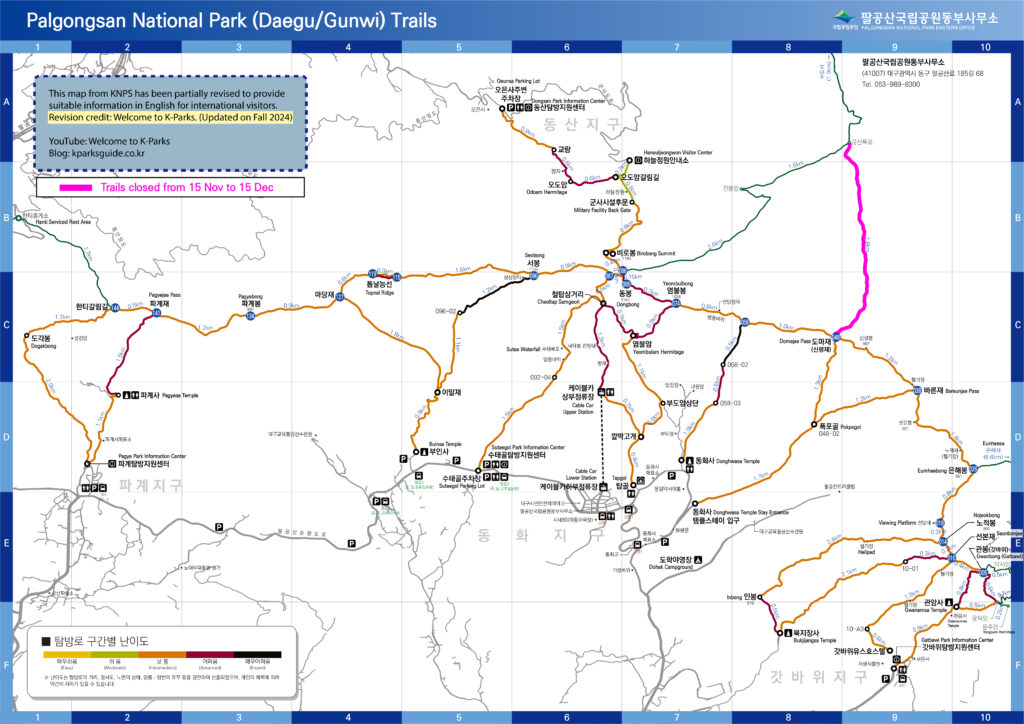
Palgongsan(Daegu-Gunwi) Map Download
- Palgongsan(Full)
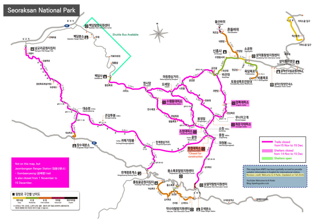
13. Seoraksan
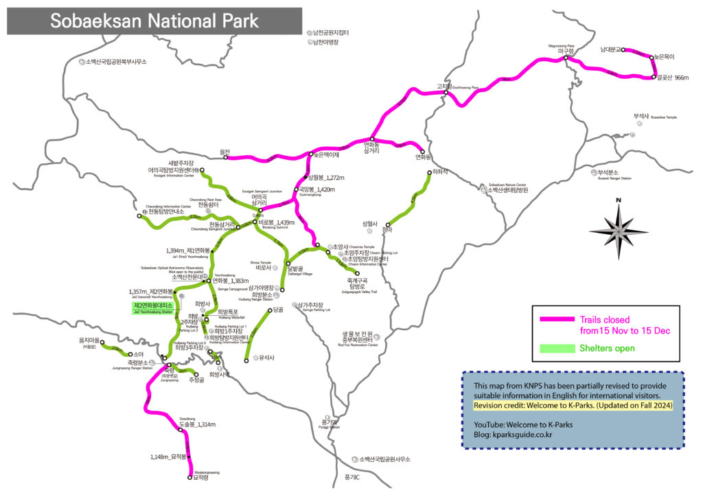
14. Sobaeksan
15. Songnisan
- Songnisan(Munjangdae area)
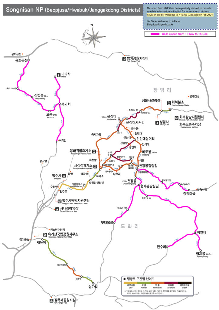
Songnisan(Munjangdae) Map Download
- Songnisan(Hwayang/Seonyudong area)
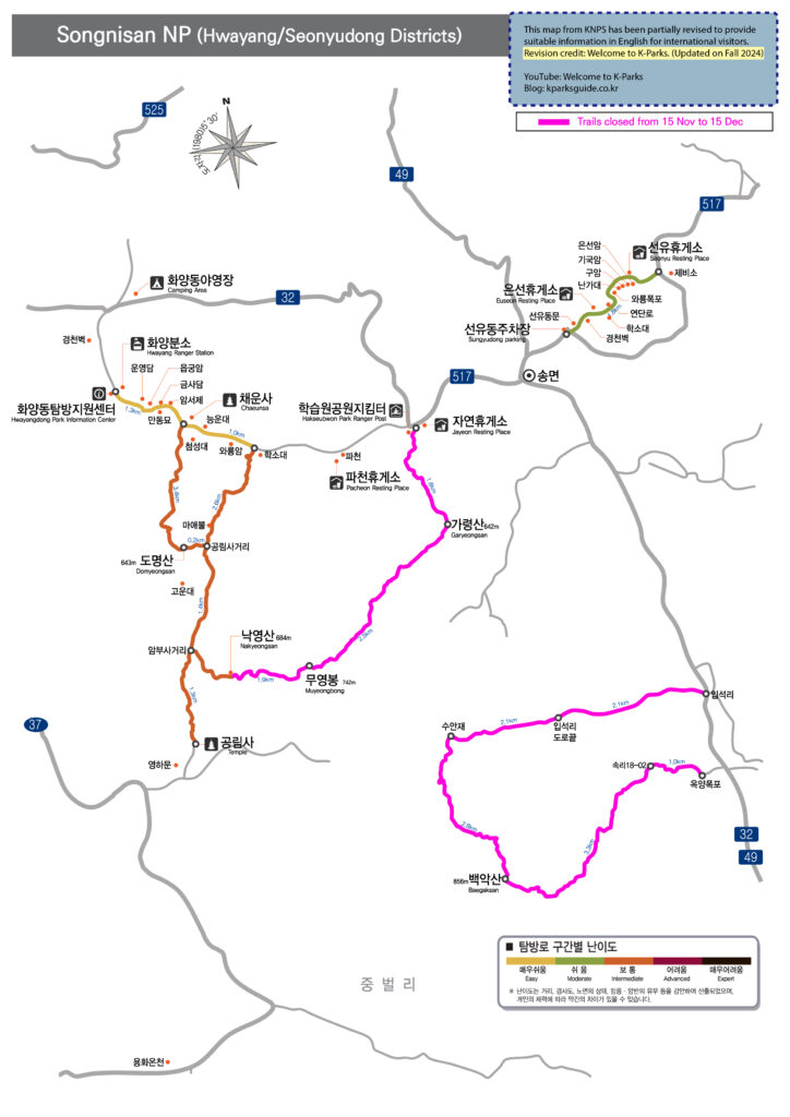
Songnisan(Hwayang-Seonyu) Map Download
- Songnisan(Ssanggok area)
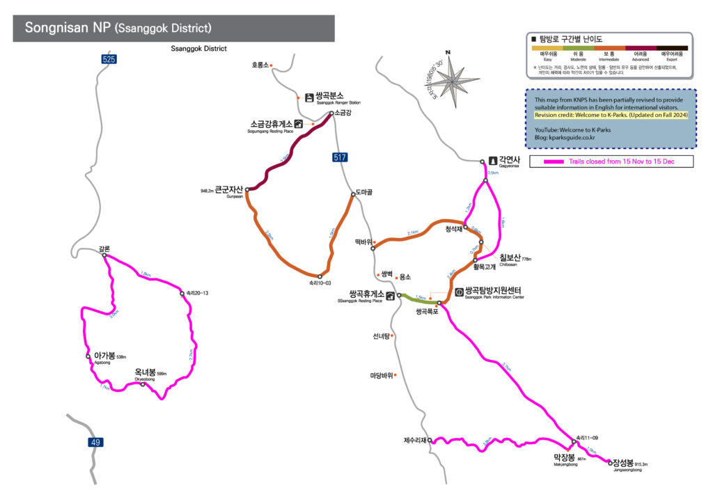
Songnisan(Ssanggok) Map Download
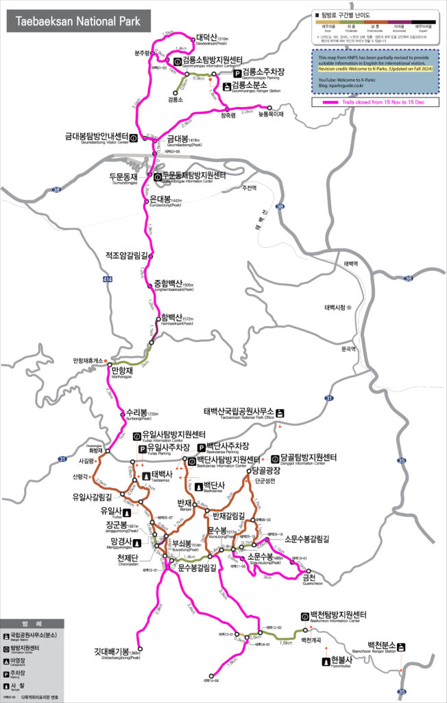
16. Taebaeksan
17. Wolchulsan
18. Woraksan
- Woraksan(Yeongbong area)
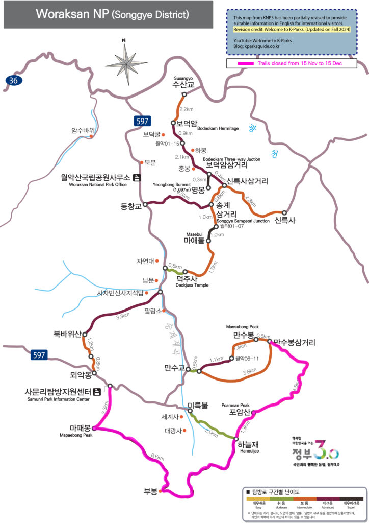
Woraksan(Yeongbong) Map Download
- Woraksan(Geumsusan-Doraksan area)
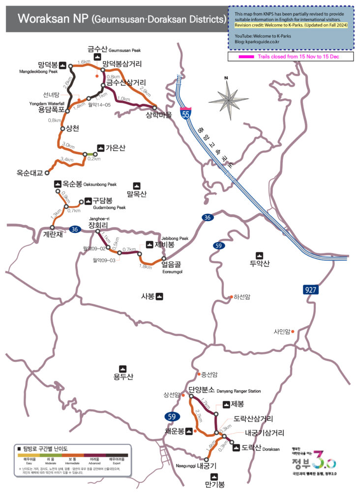
Woraksan(Geumsusan-Doraksan) Map Download
5) Penalty
Anyone who enters a restricted trail without permission is subject to a fine of up to 500,000 won in accordance with Article 86 of the Natural Parks Act.
Related phone numbers
1330: Korea Travel Hotline of Korea Tourism Organization(KTO)
1670-9201: Call Center of Korea National Park Service(KNPS)
Email inquiries: csnp@knps.or.kr